
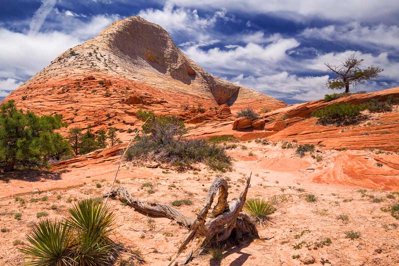
HIKES IN THE KOLOB TERRACE
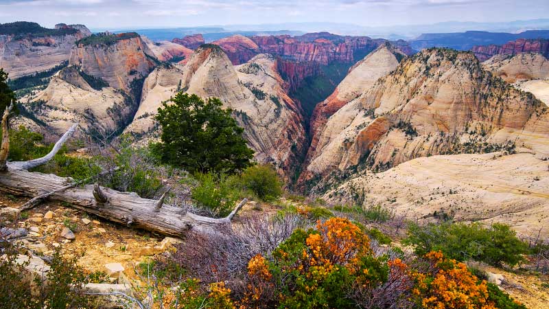
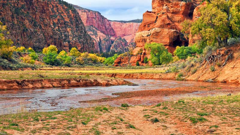
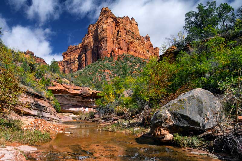
The "Kolob Terrace" is a lesser-traveled section of Zion, accessible via the Kolob Terrace Road that heads north from the town of Virgin up into Zion high country. The drive through the Terrace up to Lava Point offers a good sampling of wondrous views, from golden valleys to the majestic North and South Guardian Angels high in distance. The Kolob Terrace is home to one of the most popular canyons in Zion: the Left Fork of North Creek, aka. "the Subway." Primitive camping is available at Lava Point, the highest point in Zion National Park.

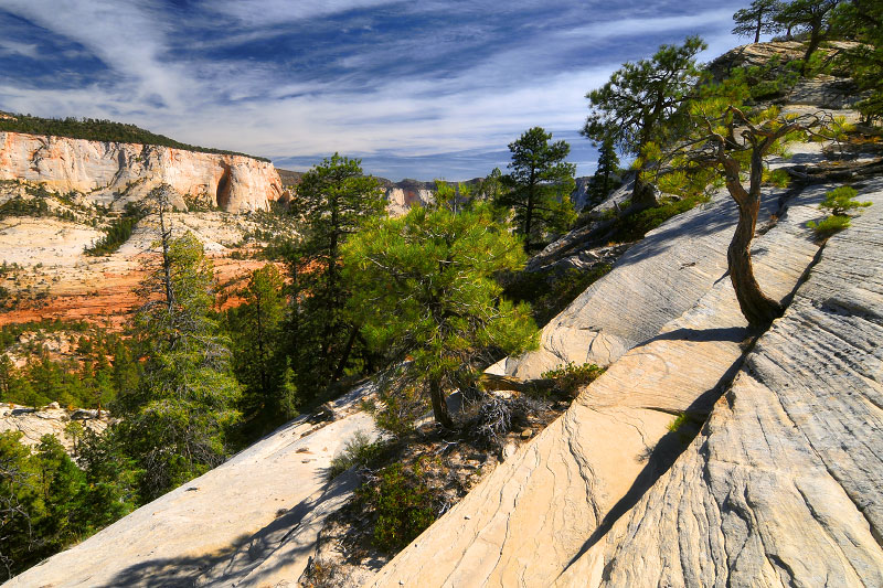
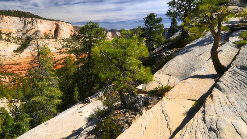
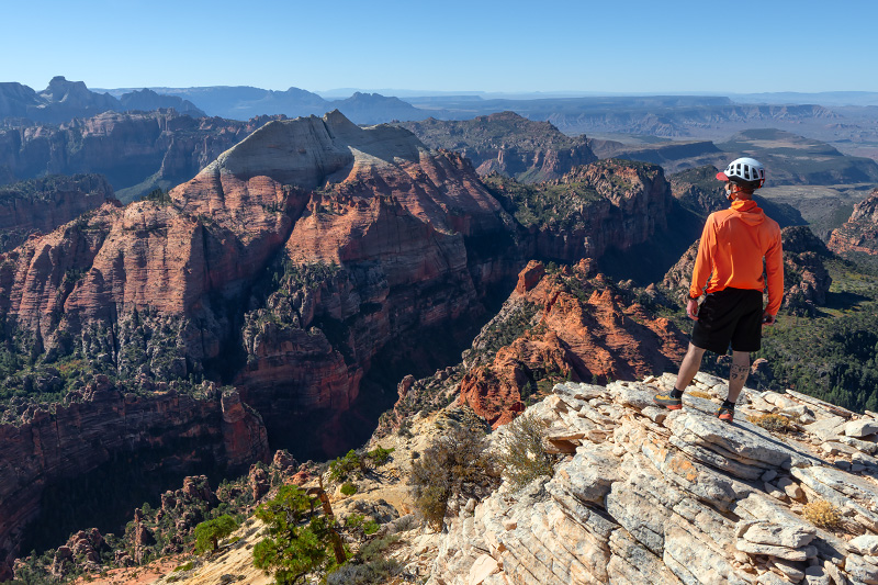
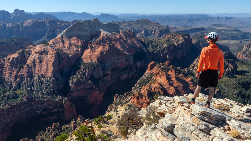
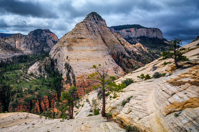
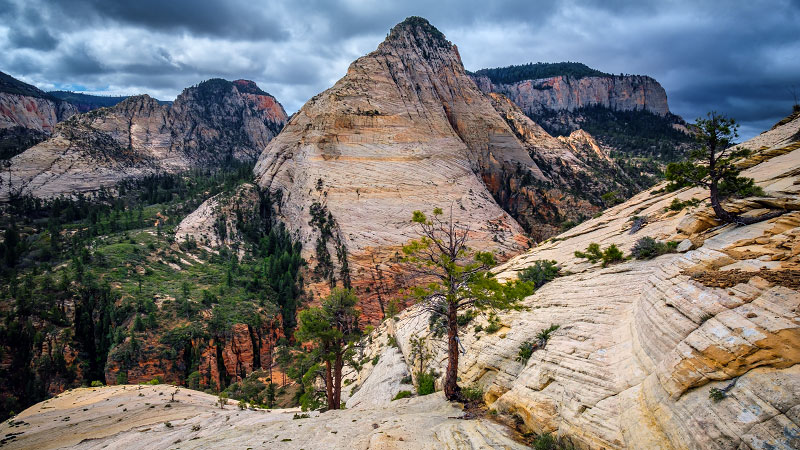
WEST RIM TRAIL (Top-Down Hike)
Fairly strenuous hiking/backpacking.
Starting from Lava Point or the West Rim Trailhead, the trek down the West Rim Trail is a long and beautiful hike along Zion's upper plateau, ending with a dramatic descent through the magical sandstone formations of the White Cliffs down to the Grotto in Zion Canyon. Numerous majestic viewpoints are found throughout the hike, including Angels Landing.


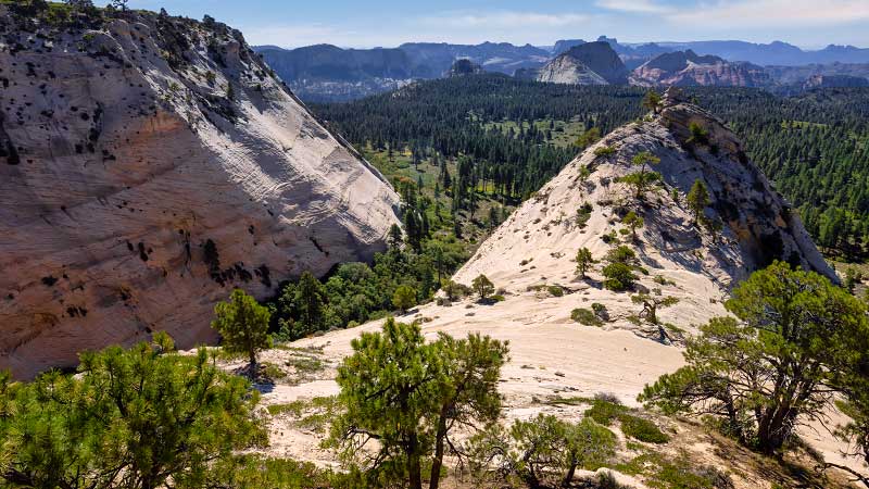
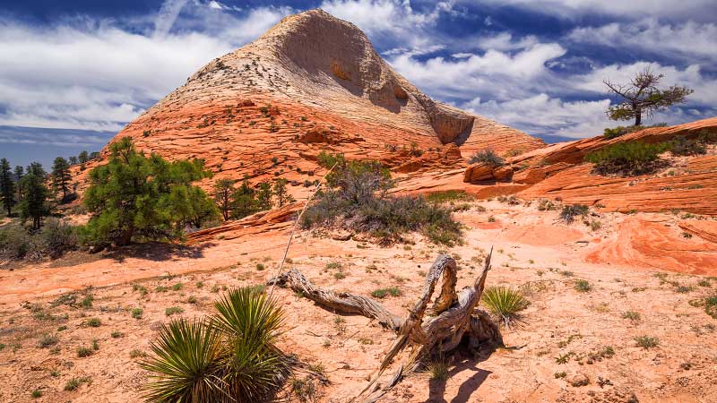
NORTHGATE PEAKS TRAIL
Moderately strenuous day hike.
The Northgate Peaks Trail is a fairly easy hike in Zion's high country to a fairly interesting viewpoint in the Kolob Terrace section of Zion, offering a nice escape from the crowds of Zion Canyon. The view at the end of the trail is a but more subtle than the views from the West Rim Trail, but it offers a fascinating peek into the Great West Canyon.
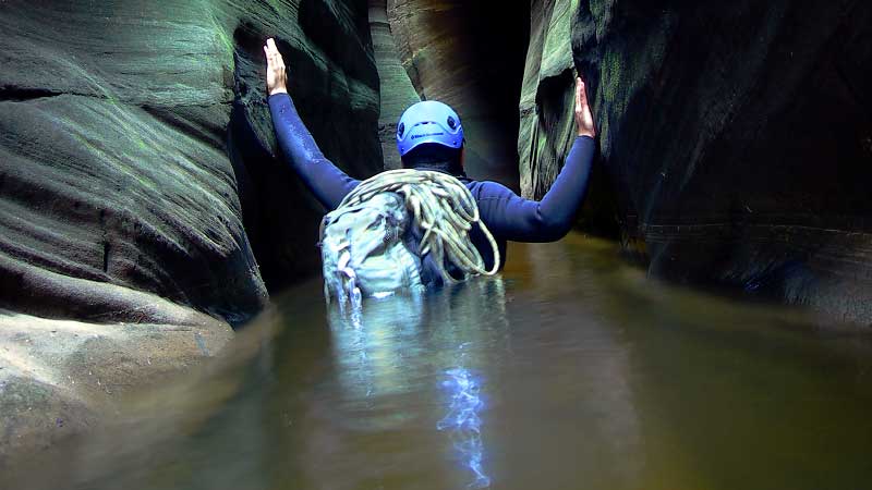
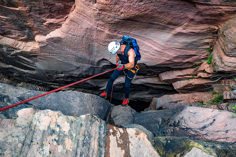
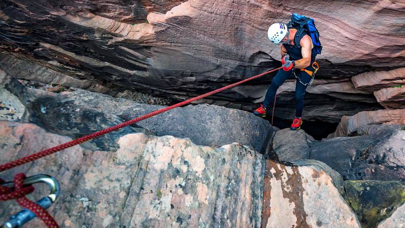
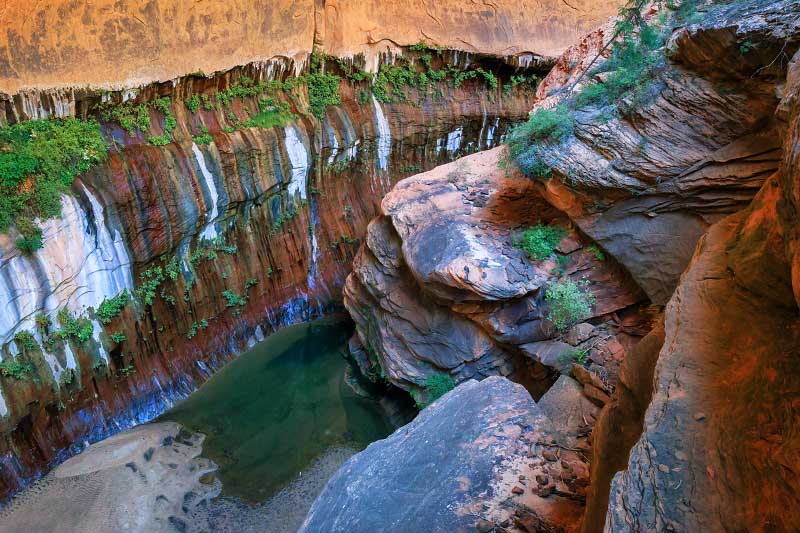
THE SUBWAY TOP-DOWN ROUTE
Strenuous semi-technical canyoneering.
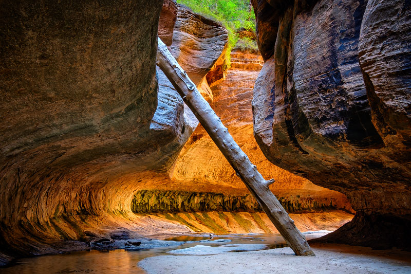
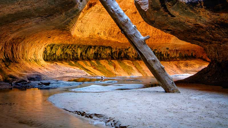
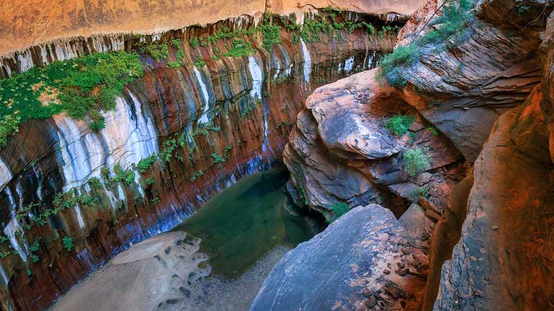
The Subway "top-down" route is a classic canyoneering hike through the Left Fork of North Creek, involving several short rappels, a few downclimbs, and several cold swims. The highlight of the day is the half-mile section of canyon known as The Subway with its famuous tubular sandstone formations. This strenuous hike is well worth the effort!


THE SUBWAY FROM THE BOTTOM
Strenuous day hike.
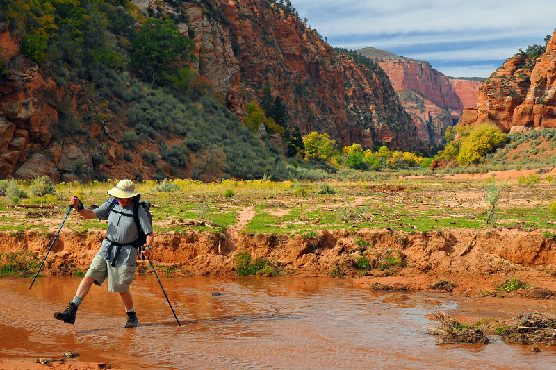
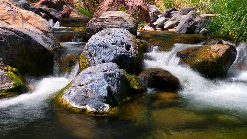
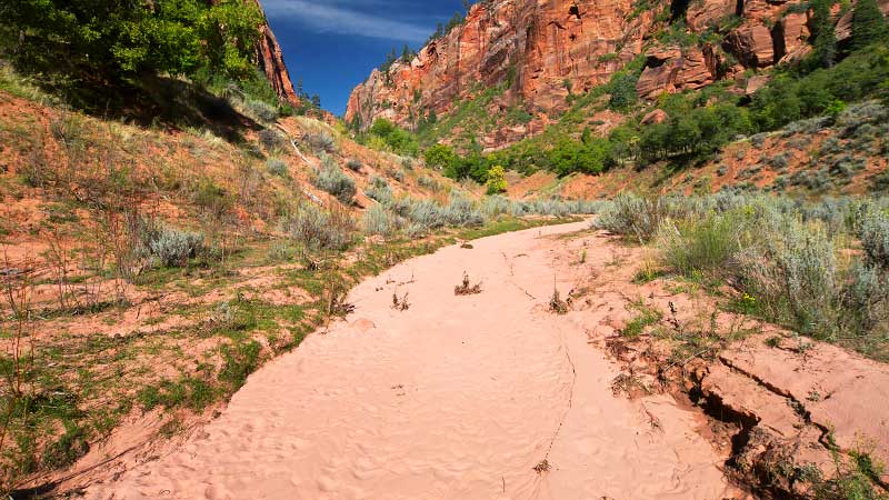
If you want to avoid the swimming and rappelling of the top-down route, you can hike the Left Fork of North Creek from the bottom. Starting at the Left Fork Trailhead, this is a non-technical route, but it is still a strenuous river hike. The payoff is seeing the beautitful waterfall cascades and the famous lower Subway formation.
DAS BOOT (Section of the Left Fork)
Strenuous technical canyoneering route.
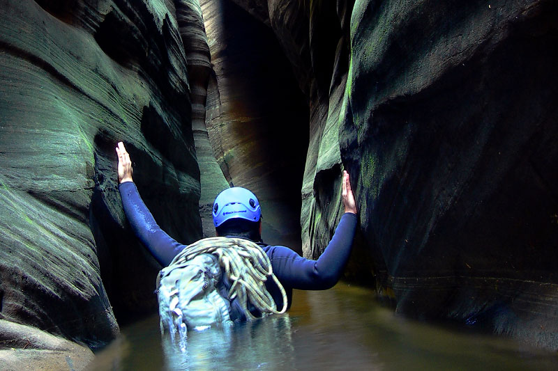
"Das Boot" is the humorously-named half-mile section of the Left Fork upstream from the standard top-down route. This strenuous section of the Left Fork feels subterranean and involves several swims, rappels, down-climbs, and exposure to year-round cold water. Wetsuits are recommended even in the blazing heat of summer.
RUSSELL GULCH (Canyoneering Route)
Strenuous technical canyoneering route.
Most people know Russell Gulch as the large pantheon at the beginning of the Subway top-down route. But while the standard Subway route crosses over and avoids the actual watercourse, a descent of Russell Gulch involves three 100-ft big-wall rappels in the belly of the canyon. This spicier start may add 1-3 hours to a top-down Subway hike.
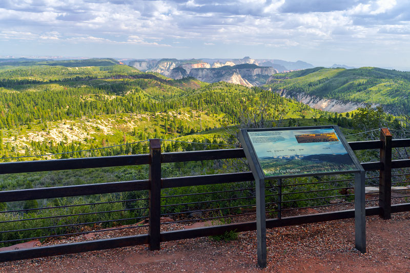
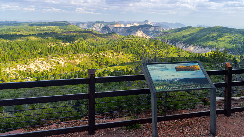
LAVA POINT
Leisurely viewpoint stroll.
For an escape from the crowds of Zion Canyon, consider a drive up the Kolob Terrace Road to see the sights of this fairly remote section of Zion National Park. Almost 20 miles up the Kolob Terrace Road is the turnoff to Lava Point, the highest drivable viewpoint in the park. A pair of viewpoints allow visitors to see the wide-open spaces to the north and to the south.


WILDCAT CANYON TRAIL
Moderate hiking/backpacking route.
The Wildcat Canyon Trail is a 6-mile stretch of trail that connects the Wildcat Canyon Trailhead with the West Rim Trail and is part of the "Trans-Zion Hike" that allows backpackers to hike from the Kolob section all the way down to Zion Canyon. While not really a destination hike, this trail wanders through some very beautiful scenery.
THE CONNECTOR TRAIL
Moderate hiking/backpacking route.
The Connector Trail is a 4-mile stretch of trail that connects the Hop Valley Trailhead with the Wildcat Canyon Trailhead. This overgrown trail is one of the least hiked stretch of trail in Zion National Park, but it is useful for backpackers who are doing the "Trans-Zion Hike" through the park. The scenery, however, is actually quite sublime.
HOP VALLEY TRAIL
Fairly strenuous hiking/backpacking route.
The Hop Valley Trail is a 6.5-mile stretch of trail that connects the Kolob Terrace with the La Verkin Creek Trail in the Kolob Canyons section. While the scenery in Hop Valley is actually quite lovely, this corner of park has a private inset of land where cattle still graze freely which can make this less than appealing to the general public.
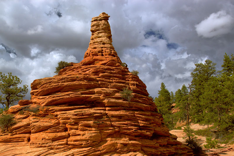
HOODOO CITY
Short easy stroll.
"Hoodoo City" is my unofficial nickname for some very cool rock formations in the cliffs just to the east of the Hop Valley Trailhead. A short 15-minute walk up and around leads to an island of hoodoos and other interesting sandstone formations.. While this is not exactly a destination hike, it could be a fun little diversion in some interesting scenery.
GRAPEVINE TRAIL (Grapevine Spring)
Short easy hike.
Along the Kolob Terrace Road between the ever-so-popular Left Fork Trailhead and the Right Fork Trailhead is the overlooked and unloved Grapevine Trailhead. The Grapevine Trail is a short route that descends through the lava cliffs and provides fairly easy access to the bottom of the Left Fork and while not a destination hike, it is a pleasant watering hole.
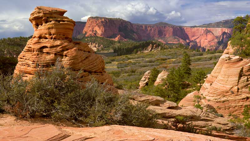
EAST AND WEST NORTHGATE PEAKS
Fairly strenuous rock-scrambling.
The family-friendly Northgate Peaks Trail ends at a viewpoint that overlooks the Great West Canyon and offers great views of the nearby peaks, most notably the nearby namesake peaks. The scramble to the top of both Northgate Peaks is a good little half-day adventure for those with scrambling/climbing experience and a tolerance for exposure to heights.
POCKET MESA
Fairly strenuous rock-scrambling.
Located less than a mile northeast of the Wildcat Trailhead, Pocket Mesa is a prominent peak formation in the Kolob Terrace landscape. A visit to the summit involves a few hours of off-trail hiking, navigating through thick manzanita and gambel oak underbrush, and a short Class 2/3 scramble to the top for some lovely views of the surrounding area.
RIGHT FORK OF NORTH CREEK (Bottom-Up Day Hike)
Strenuous and remote day hike.
Located south of the famous Left Fork of North Creek, the Right Fork is an even more remote and rugged canyon wash with challenges that include wilderness route finding, river hiking, bushwhacking, and a few tricky scrambling obstacles near the end of the route. This route is for hikers who are happy to work hard to find backcountry solitude.
RIGHT FORK OF NORTH CREEK (Top-Down Route)
Strenuous multi-day technical canyoneering route.
The Right Fork "top-down" route is a strenuous and physically challenging multi-day canyoneering route through the heart of Zion wilderness that involves rappelling, downclimbing, a few cold swims, and several route-finding challenges in some of Zion's most remote canyon scenery. This demanding route is only for experienced wilderness canyoneerers and backpackers.
NORTH GUARDIAN ANGEL
Moderately strenuous rock-scrambling/climbing route.
The North Guardian Angel is the impressive shark fin-like peak that can be seen from the end of the family-friendly Northgate Peaks Trail. A scramble/climb to the summit makes for a great half-day adventure and consists of several pitches of exposed class 3/4 sections. While this route isn't a technical climb, it is spicier and more exposed than the Northgate Peaks and should be taken seriously.
SOUTH GUARDIAN ANGEL
Strenuous remote hike with rock-scrambling.
The South Guardian Angel is one of the most distinct and remote peaks in Zion National Park's Kolob Terrace section. Located on the isolated plateau between the Left Fork and the Right Fork of North Creek, a visit to SGA is a long strenuous hike with a lot of elevation change, difficult route-finding, and rock scrambling/climbing in very remote territory.
RUSSELL GULCH to WILDCAT CANYON TRAVERSE
Strenuous off-trail hiking route.
After doing the Russell Gulch approach to Das Boot several times and after exploring down Wildcat Canyon, I was intrigued with the possibility of connecting the two, and fortunately you can! The Russell Gulch to Wildcat Canyon Traverse is a hiking route along the shelves above the Left Fork of North Creek that allows you to see all of this great remote scenery as a long lollipop route.
LANGSTON CANYON and LANGSTON MOUNTAIN
Strenuous remote hike with rock-scrambling.
Tucked away behind a tall sandbar on the eastern side of Hop Valley, Langston Canyon might not even be noticed by those hiking through. The hike up Langston Canyon to Langston Mountain is a long and challenging route that involves a lot of bushwhacking, steep uphills, boulder-scrambling, and navigation challenges in remote territory to see some great remote scenery.

