
HIKES IN THE GREATER ZION AREA
The awesomeness doesn't just end at the arbitrary borders of Zion National Park. There is a lot of amazing canyon and mountain scenery in the surrounding public lands, many of which are managed by the BLM (Bureau of Land Management) or the US Forest Service. Some of the hikes below are in popular touristy areas regulated by a permit system; others are in extremely remote wilderness areas where nobody will find you if you become lost or injured. Be sure to read the specifics for each hike below and be respectful of neighboring private lands to ensure future access for others.


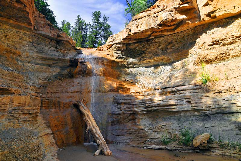
KANARRA FALLS (Kanarra Creek)
Moderately strenuous river hike.
Tucked behind the town of Kanarraville, roughly 7 miles north of the Kolob Canyons section of Zion National Park, is the beautiful little Kanarra Creek slot canyon, comparable to a mini version of the famous Zion Narrows. Referred to more popularly as "Kanarra Falls" these days, a permit system with daily quotas has been put in place to control the crowds.
SPRING CREEK and SWEETWATER GULCH
Moderately strenuous day hike.
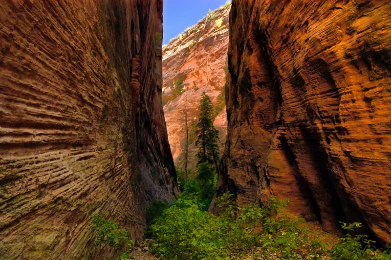
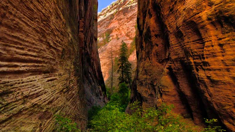
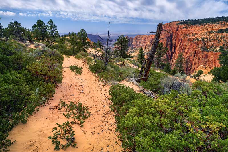
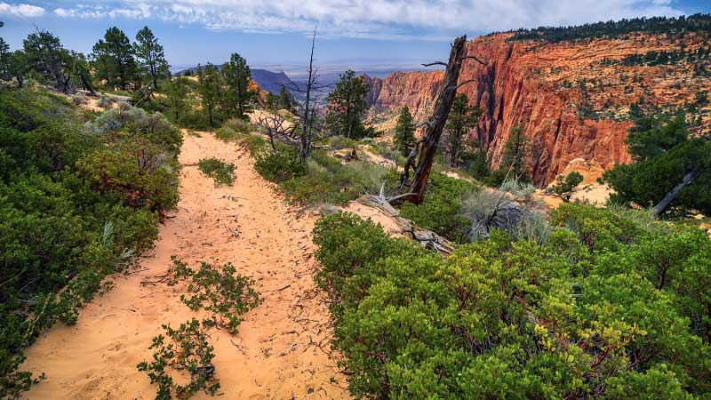
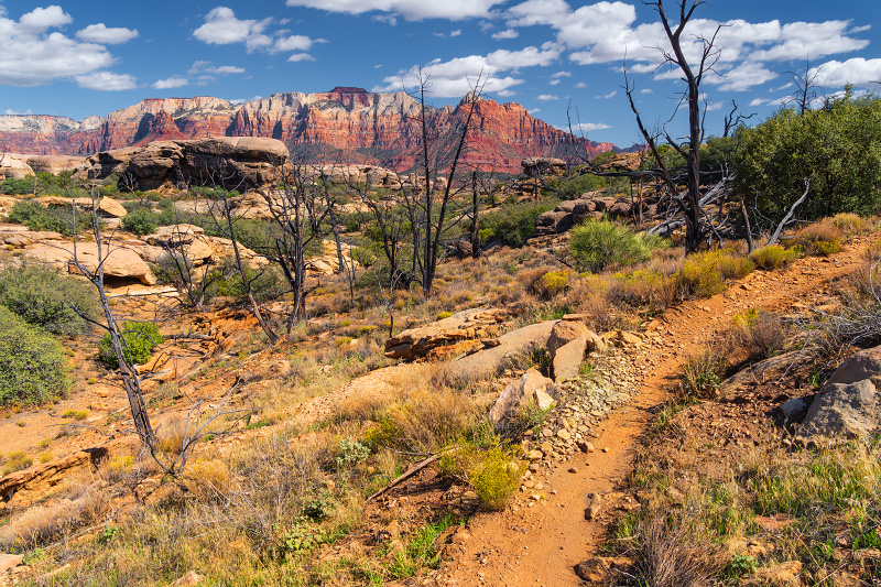
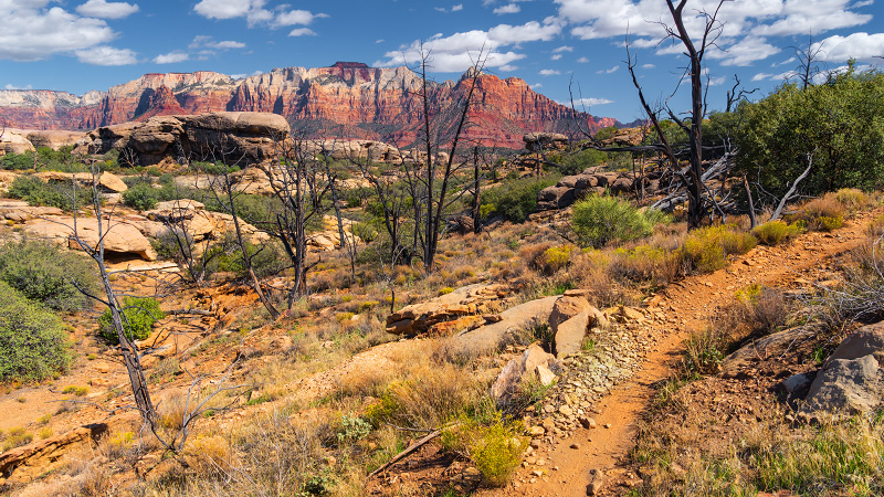
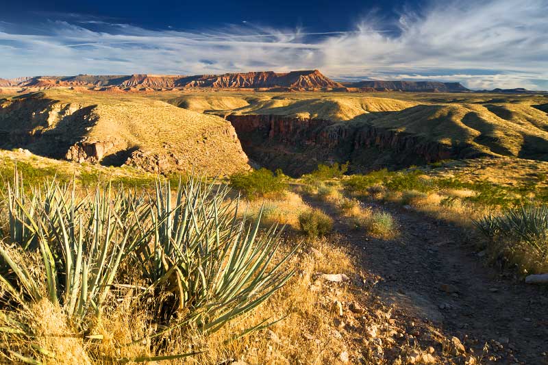
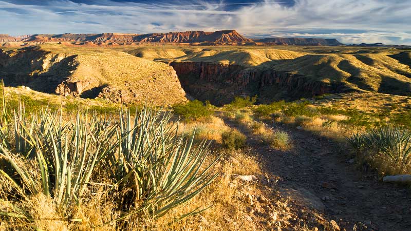
Spring Creek is a canyon in BLM land just north of the Kolob Canyons section of Zion National Park. While not the most beautiful or stunning, this remote canyon is a pleasant day hike if you want to get away from it all. The golden section of this hike is Sweetwater Gulch -- a beautiful tributary with towering vertical walls on both sides of the canyon.
GRAFTON (Ghost Town)
Family-friendly stroll.
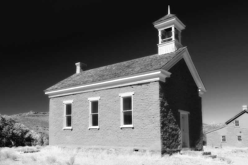
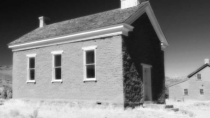
Located south of the town of Rockville outside of Zion National Park, the ghost town of Grafton was settled in 1859 and abandoned less than a decade later. The site is now maintained by the Grafton Heritage Partnership and includes several historic buildings (several which have been restored) and an old cemetery. A visit to Grafton makes for a pleasant family stroll through history.
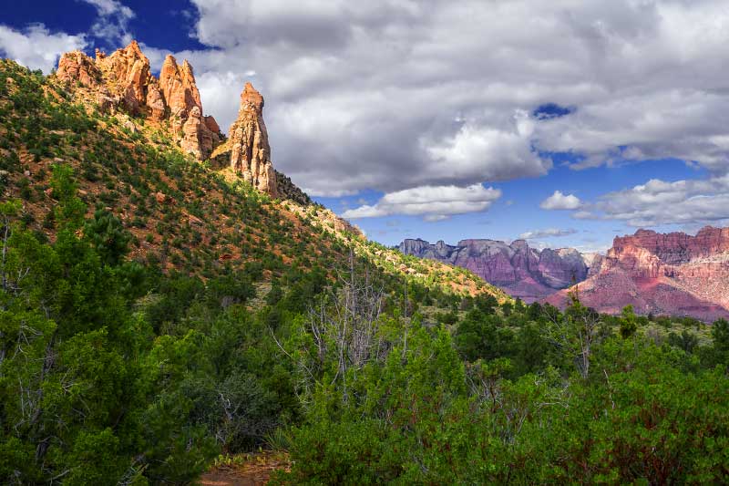
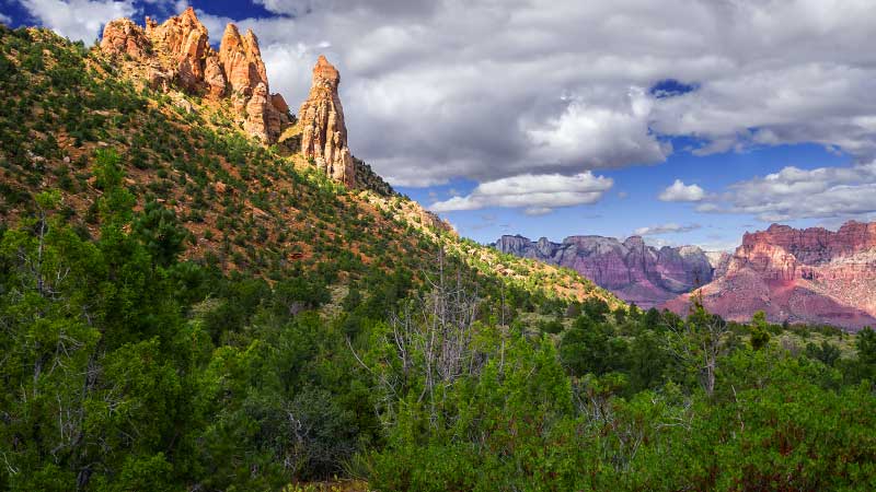
EAGLE CRAGS TRAIL
Moderately strenuous to strenuous hike.
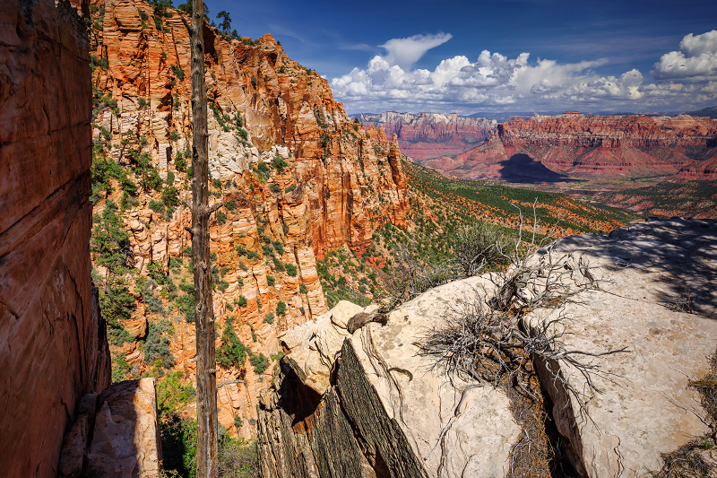
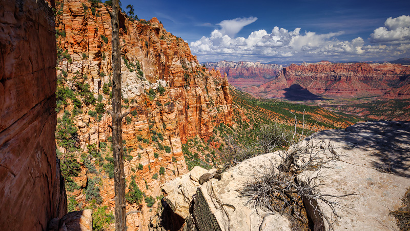
The Eagle Crags are jagged rock formations in BLM land south of Springdale. The Eagle Crags Trail is a pleasant half-day hike that approaches and circles east of the Vermilion Cliffs to end just under the imposing Eagle Crags formations. And for those looking for something longer and more strenuous, the hike can be extended to reach the top of Lower Mountain.
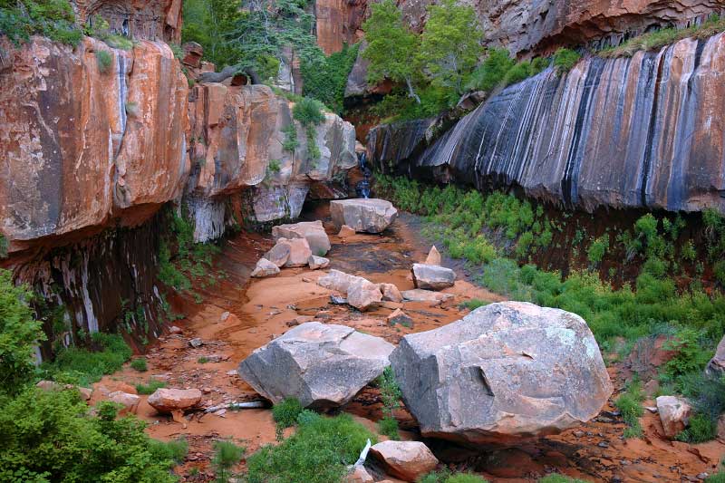
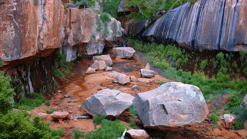
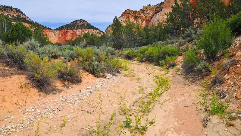
WATER CANYON and CANAAN MOUNTAIN
Moderately strenuous to strenuous hike.
Located on BLM land behind the remote town of Hildale near the Arizona border several miles south of Zion National Park, Water Canyon is a beautiful little canyon oasis reminiscent of Zion's Subway. A clever trail heads up the canyon and ascends fractures on the west side of the canyon to make it all the way up to the top of the Canaan Mountain wilderness.
SQUIRREL CANYON (to Water Canyon Arch)
Fairly strenuous day hike.
Also located on BLM land behind the remote town of Hildale, Squirrel Canyon is one canyon east of Water Canyon and also provides hikers with an enjoyable route up into the Canaan Mountain Wilderness. After connecting with the Sawmill Trail, a good destination for dayhikers is the top of the Water Canyon Arch looking down on Water Canyon.
CANAAN MOUNTAIN TRAVERSE
Very strenuous backpacking route.
If you have hiked the Eagle Crags Trail behind Rockville as well as the Water Canyon Trail behind Hildale near the Arizona border, you might be intrigued by the idea of linking the two day hikes into a long strenuous trek across the lonely rugged terrain of Canaan Mountain. The Canaan Mountain Traverse is an ingenious 15-mile route that connects Hildale to Rockville.
GUACAMOLE TRAIL (The Whole Guacamole)
Moderately strenuous to strenuous day hike.
Located just outside the desert section of Zion, the Guacamole Trail is a collection of whimsically named mountain bike trails that wander around the scenic landscape surrounding Crater Hill. While development of this trail system was primarily by and for mountain bikers, this is actually a great place for hikers as well, offering great rim views and an opportunity to wander through the unique goblin dome formations.
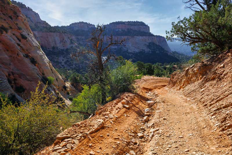
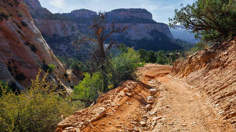
LAMBS KNOLL
Moderately strenuous hiking/scrambling route.
Located along the Kolob Terrace Road between the Left Fork Trailhead and the Hop Valley Trailhead, Lambs Knoll is an isolated mountain-ish formation on BLM land just outside of the Zion National Park boundary. Despite its smallish size, Lambs Knoll has a very complex sandstone structure full of nooks, crannies, gullies, and alcoves, making it an interesting spot for hikers, climbers, and canyoneers alike.
LA VERKIN OVERLOOK TRAIL
Moderately strenuous day hike.
Roughly 19 miles west of Zion National Park, the La Verkin Overlook Trail is a short old trail on BLM land that skirts the edge of the cliffs above La Verkin and offers good views down into an impressive section of the Virgin River gorge. While this isn't a destination hike for tourists visiting Zion National Park, the viewpoint and trail can be a fun diversion.
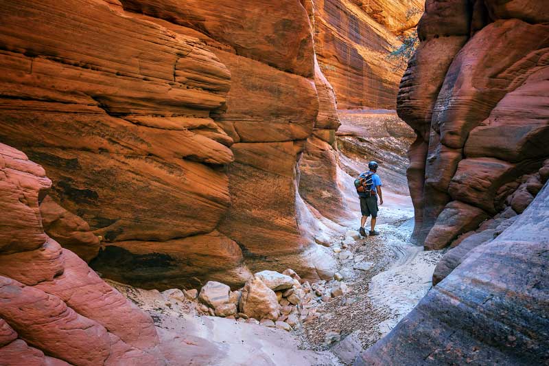
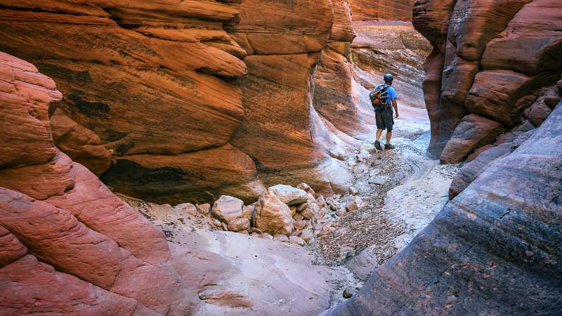
THE BARRACKS (Upper Parunuweap Canyon)
Strenuous river hiking/backpacking.
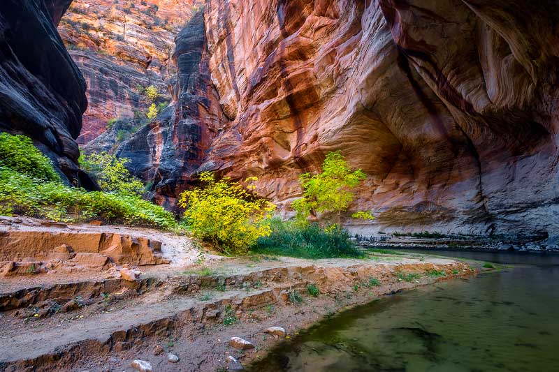
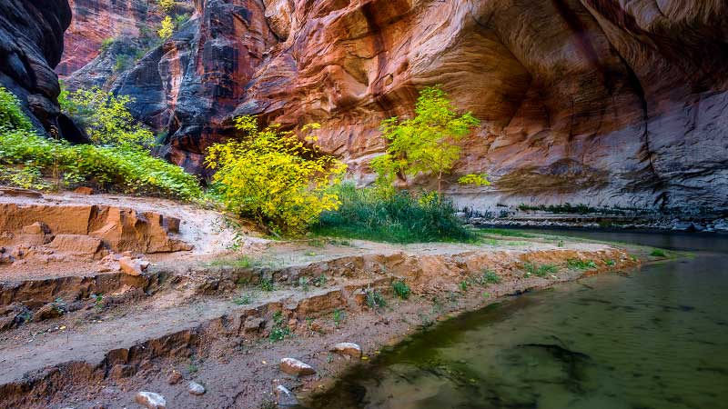
In BLM territory east of the NPS boundary is a beautiful and remote stretch of canyon known as the East Fork of the Virgin River (aka "the Barracks"). This route starts near Mt. Carmel Junction and follows the East Fork for almost 20 miles into scenery that is reminiscent of the popular Zion Narrows. The long and brutal uphill exit hike will make you regret your life's choices.
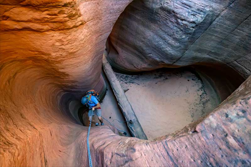
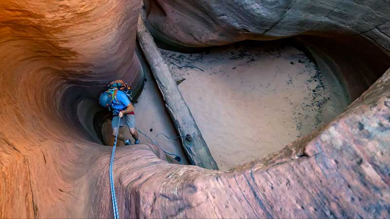
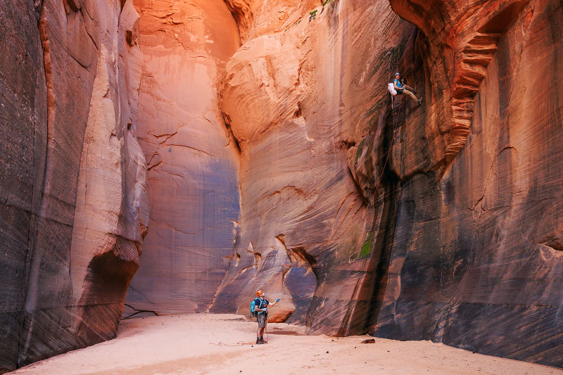
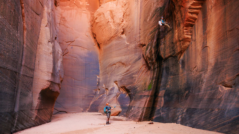
MISERY CANYON (Fat Man's Misery)
Strenuous technical canyoneering route.
Misery Canyon is a technical canyon that skirts the eastern border of Zion National Park and the approach hike starts from Checkerboard Mesa Canyon within the NPS boundary. While Misery isn't too technically difficult, it is a physically demanding slot canyon that ends in the beautiful Barracks section of the East Fork and requires a long and brutal uphill exit hike.
EAST FORK of MISERY CANYON
Strenuous technical canyoneering route.
While most descend Misery Canyon via the West Fork, the East Fork of Misery Canyon is also an interesting route through a remote and photogenic stretch of slot canyon. Like the standard West Fork route, the approach hike starts from Checkerboard Mesa Canyon within the NPS boundary, but the East Fork makes for a longer and more strenuous day in some very remote territory.
POVERTY TRAIL and POVERTY WASH
Fairly strenuous hiking.
"Poverty Trail" is a nickname for an old cattle trail that heads south from Route 9 into BLM land to reach the East Fork of the Virgin River. These days, it is part of a network of ATV trails that wander around the White Cliffs. While not the most exciting route, this 7.5-mile trek is a bit of a shortcut to get down into Parunuweap. Nearby Poverty Wash is a drainage that is also worthy of exploring.
MEADOW CREEK and MINERAL GULCH
Strenuous hiking/backpacking.
If you have driven on Route 9 between Zion National Park's east entrance and Mt. Carmel Junction, you may have noticed the intriguing Meadow Creek and Mineral Gulch canyon systems heading south from the road. While the scenery in Meadow Creek and Mineral Gulch might not be considered stunning, this area offers an interesting desolate hiking experience.
ROCK CANYON and FRENCH CANYON
Fairly strenuous remote canyoneering.
Rock Canyon is a beautiful little technical slot canyon located in some really remote territory on the south side of Parunuweap Canyon. For those with an ATV that can drive 13 miles on a deep sand track to get to the trailhead, this can be a one day adventure, but alternatively, Rock Canyon can be included as part of a longer backpacking/canyoneering trek using French Canyon to complete a loop.

