Located just outside the desert section of Zion National Park on the mesa high above the towns of Virgin and Rockville, the Guacamole Trail is a collection of whimsically named mountain bike trails that wander around the scenic landscape surrounding Crater Hill. While development of this trail system was primarily by and for mountain bikers, this is actually a great place for hikers as well, offering scenic rim views and an opportunity to wander through the unique goblin dome formations of the area with the West Temple standing far off in the distance.
| Rating: Moderately strenuous to strenuous day hike |
| Access: Dalton Wash Road to the Guacamole Trailhead |
| Time Required: 3-4 hours for the Guacamole Loop; 5-7 hours for the Whole Guacamole. |
| Length: 6 miles for the Guacamole Loop; 11 miles for the Whole Guacamole. |
| Elevation Change: mostly level with a 300-ft gradual descent and ascent along the Holy Guacamole loop |
| Seasons: Year-round, but recent rain or snow can make access difficult. Summer can be brutally hot. |
NOTE: The write-up below is intended mostly for hikers. There are very few sections of the Guacamole Trail system where there is much danger for blind collisions, but when hiking, please stay alert with your ears listening and step off the trail and out of the way to allow bikes to pass.
 |
Guacamole Trail Map: Margarita Trail, Salt on the Rim, Lime with a Twist, Holy Guacamole, etc. |
From the town of Virgin, drive east on Route 9 for 1.5 miles and then head north on the Dalton Wash Road. Follow the dirt road for roughly 4.5 miles up two levels of mesas to get to the Guacamole Trailhead. (The road is surrounded by private property so please stay on the main road and obey any "no tresspassing" signage.) The final push to the top of Guacamole Mesa is a bit steep but can be done by most 2WD vehicles in dry conditions. Look out for vehicles going in the opposite direction! At the top of the hill are a few obvious parking areas just to the south.
The original "Guacamole Trail" name was first documented around 2006 by mountain bikers, but its informal use predates that. One of the big draws for mountain bikers is an area of goblin dome/white knob sandstone formations located just southwest of Crater Hill that make for fun and challenging technical riding.
The trail system evolved into a lollipop-shaped network with the main stem from the parking lot, now known as the "Margarita Trail", leading to various loops and spurs. "Lime with a Twist" and "Holy Guacamole" are additions to the network that were added between 2010 and 2015.
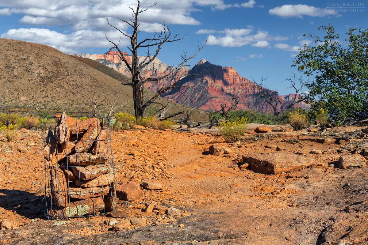
The original trail was pieced together informally by local riders, but by 2015, the Zion Regional Collaborative started managing the trails and now there is a trail committee that supports planning and maintenance. The trails are still notable for their quirky and grassroots markers: caged cairns, decorated paint cans, stick formations, and colored blazes that creatively mark the way. "The Whole Guacamole" now refers to the entire collection of trails that can be done in one giant loop.
For hikers, there are two likely interesting loop options. The first is a simple lollipop loop hike along the Margarita Trail and the Guacamole Loop (roughly 6 miles, 3-4 hours). The second option is "the Whole Guacamole": doing a lollipop loop hike that includes all of the outer spurs (roughly 11 miles, 5-7 hours). Since the far "Holy Guacamole" loop has some of the best scenery in the area, the longer loop is definitely recommended if you have the time and energy. (While there are many inner loop options, going counter-clockwise on the outer loop is probably the best bet for catching the scenery.)
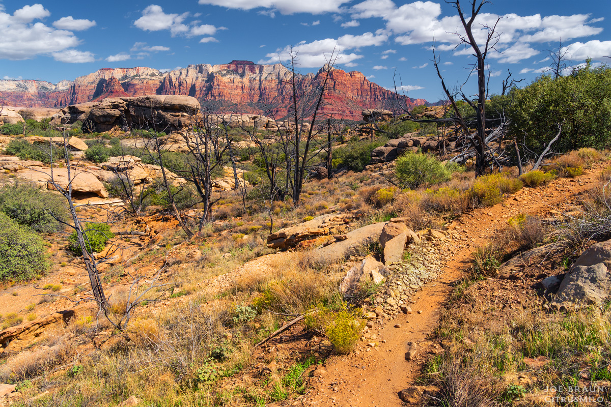
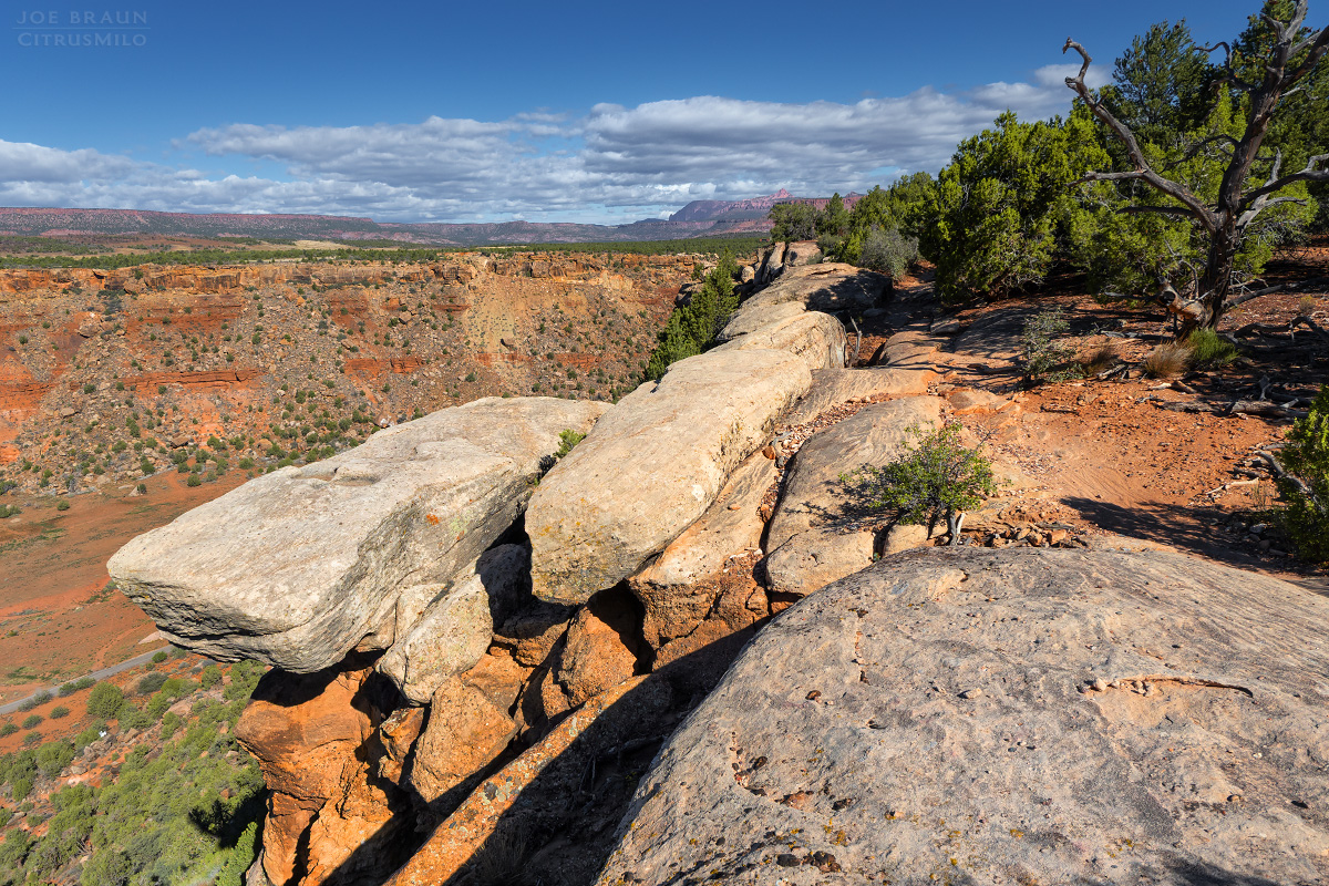
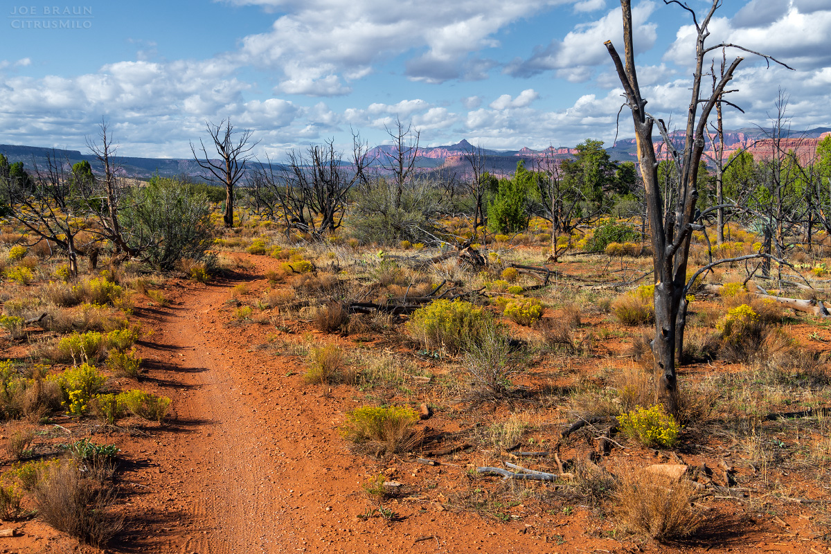
Starting from the Guacamole Trailhead, hike across the open slickrock looking for rock cairns and white markers painted on the slickrock. Following the trail can be a bit difficult at first, but navigation gets easier as the trail becomes more defined near the rim. The "Salt on the Rim" spur offers some nice views from the rim down into Dalton Wash below. By the time you reach the Guacamole loop, the mesa is filled with goblin dome/white knob formations that are fun to explore. Several of the goblin domes have unique erosion formations, from large alcoves to numerous pitted pore patterns; the geology is really quite fascinating.
Rusted paint cans covered in stickers and various rocks and sticks mark trail junctions and extinct volcano, Crater Hill, can be seen in the distance to the east. When you get to the outer "Lime with a Twist" loop, make sure to look for the outer track which can be faint and difficult to follow in spots. (Since the trails run close to each other, it's very easy to accidentally switch trails without realizing it.)
The southern "Holy Guacamole" loop is probably the highlight of the hike. The loop hits several interesting spots along the rim that offer scenic views before wandering through some of the most interesting goblin domes of the area. Along the way, you will also see great views of West Temple far off to the east as well as interesting pieces of petrified wood scattered along the trail. When you reach the last segment of Holy Guacamole, you will be skirting up against one of the loneliest NPS fences at the Zion National Park boundary. Head back along the Guacamole Loop and Margarita Trail back to the parking area.
I have to admit that I thought this hike would be fairly boring, but I had an absolute blast hiking the entire loop and seeing all of the unique scenery! Wandering through the goblin domes was a real treat, along with seeing numerous viewpoints from the rim of the mesa. The cooler shoulder months are probably the best time to enjoy this hike because it would be brutally hot out here on a sunny summer day.
Please note: This web site and all images on this site are the property of CitrusMilo Adventures ©2025. Unauthorized public or commercial use of any of the images or text on this website without explicit permission is strictly forbidden.


