
The Highest Viewpoint in Zion National Park:
For an escape from the crowds of Zion Canyon and reprieve from the hotter temperatures at lower elevations, consider a drive up the Kolob Terrace Road to see the sights of this fairly remote section of Zion National Park. Almost 20 miles up the Kolob Terrace Road is the turnoff to Lava Point, the highest drivable viewpoint in the park. A pair of viewpoints allow visitors to see the wide-open spaces to the north and to the south. While the views might not be as stunning as Observation Point or Angels Landing, a visit to Lava Point is a pleasant diversion.
Driving to Lava Point:
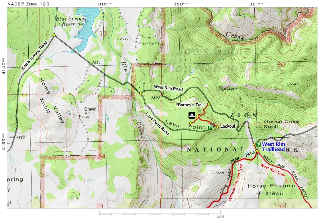
From Springdale, drive west to the town of Virgin, then turn north on the Kolob Terrace Road. It is roughly a 19-mile drive up through the Kolob Terrace Section until the well-signed dirt road turnoff for Lava Point. Once in the NPS boundary, at the road junction, stay right to head to Lava Point; the final stretch to Lava Point is mostly level and is easily accessible by non-4WD vehicles.
Note: The road left leads down to the West Rim Trailhead. If you are planning on hiking the West Rim Trail, driving down this road can save you 1.2 miles of hiking from Lava Point, but it may be a problem for non-4WD vehicles in wet conditions. When doing the top-down West Rim Trail hike, consider paying one of the Springdale outfitters' shuttle services for a ride to Lava Point. It will save you the effort of having to retrieve your vehicle after your hike.
A Visit to Lava Point:
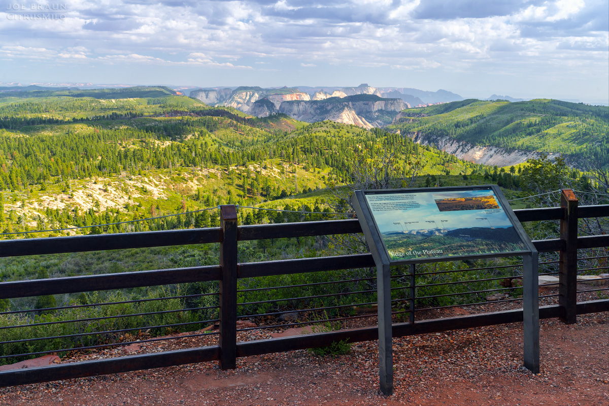
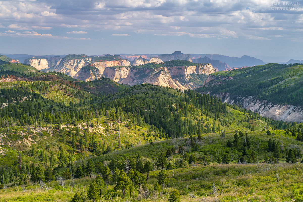
Once you have arrived at Lava Point, there are a handful of parking spaces close to the viewpoints. It is a short stroll to the main viewpoint that faces south that is marked by a sturdy fence and display placard. Visitors are treated to a pleasant teaser view of Wildcat Canyon and the White Cliff formations above the Left and Right Forks of North Creek (aka "the Great West Canyon"). And while you can't really see down into Zion Canyon from Lava Point, West Temple is clearly visible standing tall far off in the distance.
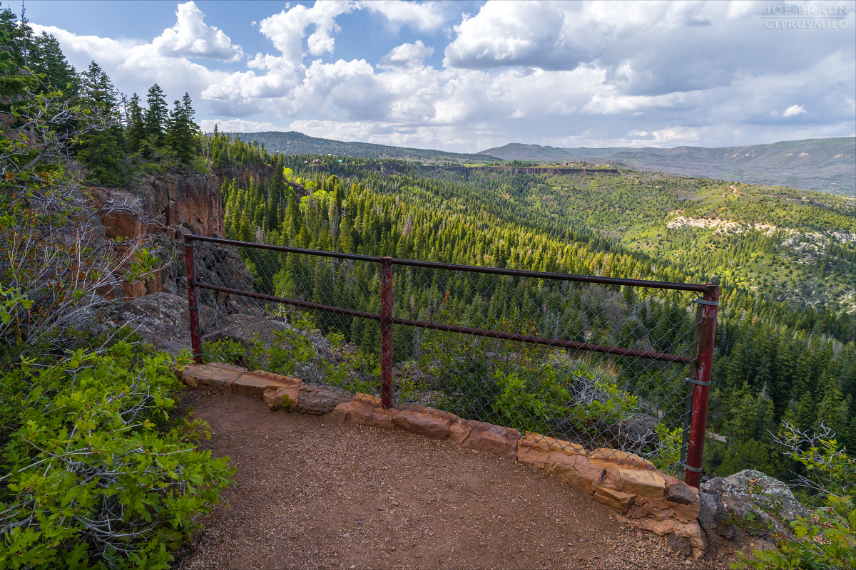
Take a short stroll to the north to visit the smaller viewpoint that faces north to get a good look at the old cliffs of lava rock that are slowly crumbling into the landscape below. Several picnic tables are scattered around the area for visitors who want to soak in the area longer.
Lava Point Campground:
Just west from the viewpoints is the Lava Point Campground, a small primitive campground consisting of 6 sites. While the campground used to be first come, first served, reservations are now required and can be purchased at recreation.gov. Please do not squat or set up camp if you do not have a permit for a specific campsite.
Longer Hiking Options:
From the Lava Point viewpoints, a short level trail connects to the campground, and near the campground is the start of "Barney's Trail", a shortcut trail that makes its way down through the lava cliffs to join up with the West Rim Road that heads to the West Rim Trailhead.
Most hikers will want to do a one-way hike along the West Rim Trail down into Zion Canyon, but if you are camping at Lava Point or want to do an out-and-back hike, you can reasonably hike down the West Rim Trail to the "SGA Teaser Viewpoint" and back; that would be a roughly 8-mile hike with a steady uphill on the way back to Lava Point. Another option is to head down the Wildcat Canyon Trail, although the views are fairly muted in comparison.

Joe's Spin:
While Lava Point might not be the most stunning viewpoint in Zion National Park, it is still a pleasant destination for a joyride through the Kolob Terrace section of Zion National Park. Consider a drive to Lava Point after hiking the Northgate Peaks Trail, and also consider driving further north to see the Kolob Reservoir just north of the park.

