
An Interesting Landmark along the Kolob Terrace Road:
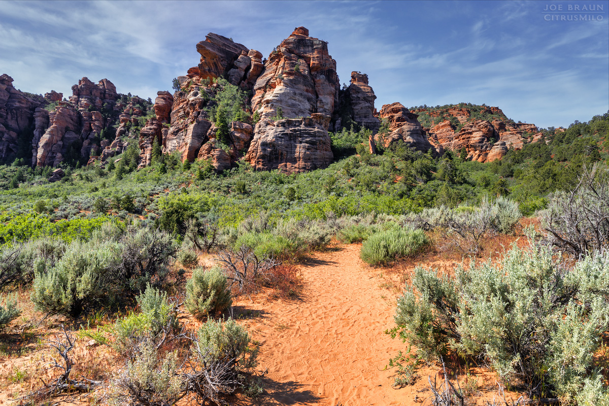
Located along the Kolob Terrace Road between the Left Fork Trailhead and the Hop Valley Trailhead, Lambs Knoll is an isolated mountain-ish formation on BLM land just outside of the Zion National Park boundary. Despite its smallish size, Lambs Knoll has a very complex sandstone structure full of nooks, crannies, gullies, and alcoves, making it an interesting spot for hikers, climbers, and canyoneers alike.
While many people know Lambs Knoll as a spot for guided climbing and canyoneering/rappelling lessons, you can come here and hike on your own as well. The focus of this write-up is on hiking and scrambling up to the various summit points located around the landmark.
Getting to the Trailhead:
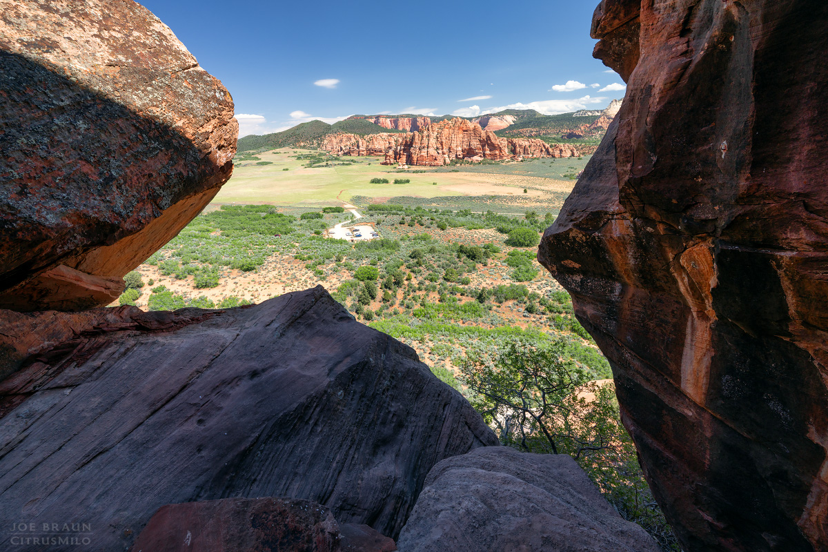
To get to the Lambs Knoll Trailhead from Springdale, drive west to the town of Virgin, then turn north on the Kolob Terrace Road. It is roughly a 10.5-mile drive up the Kolob Terrace Road to the Lambs Knoll turnoff on the left (west). In recent years, BLM has done a great job of improving the access road and constructing a formalized parking area, providing easy access to visitors.

Hiking up Lambs Knoll:
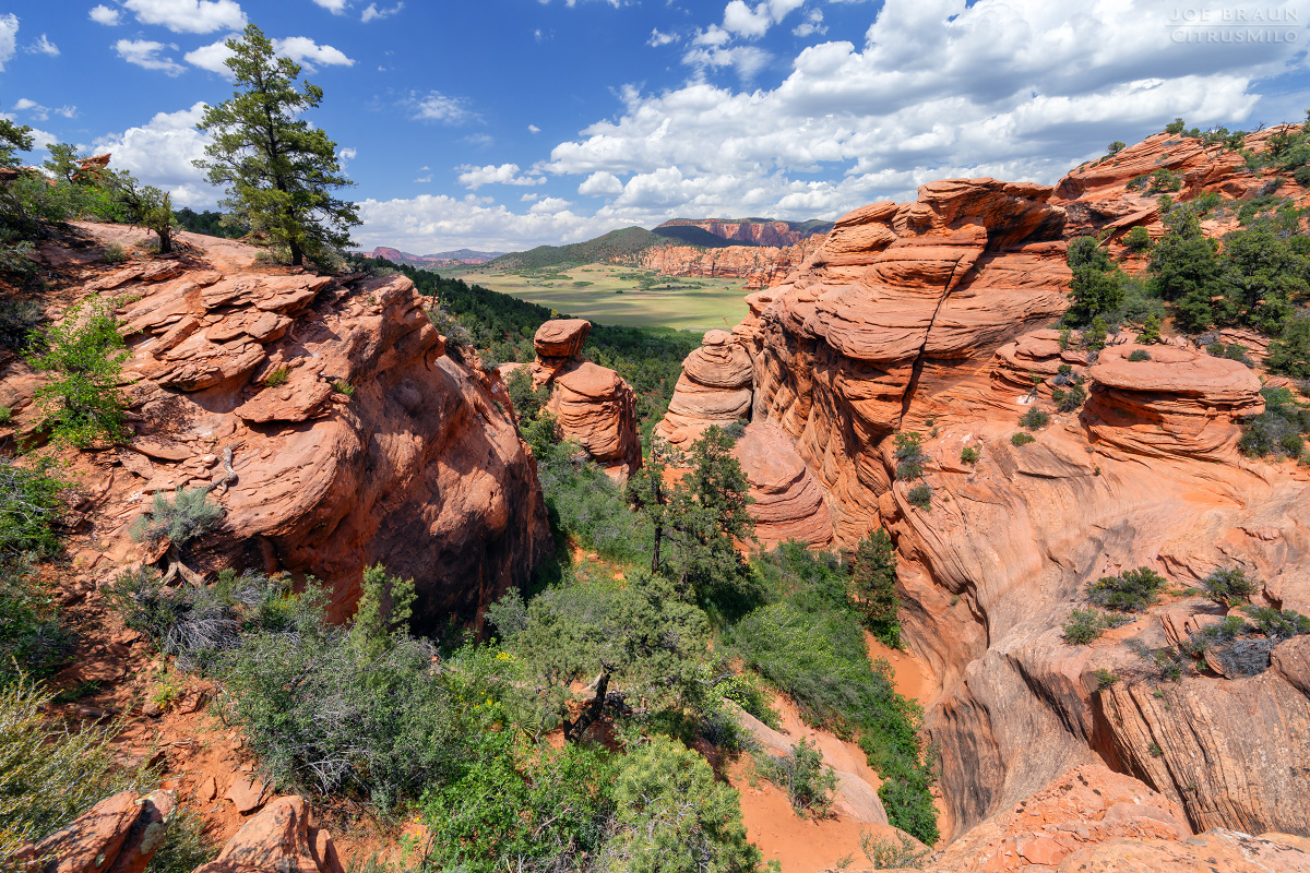
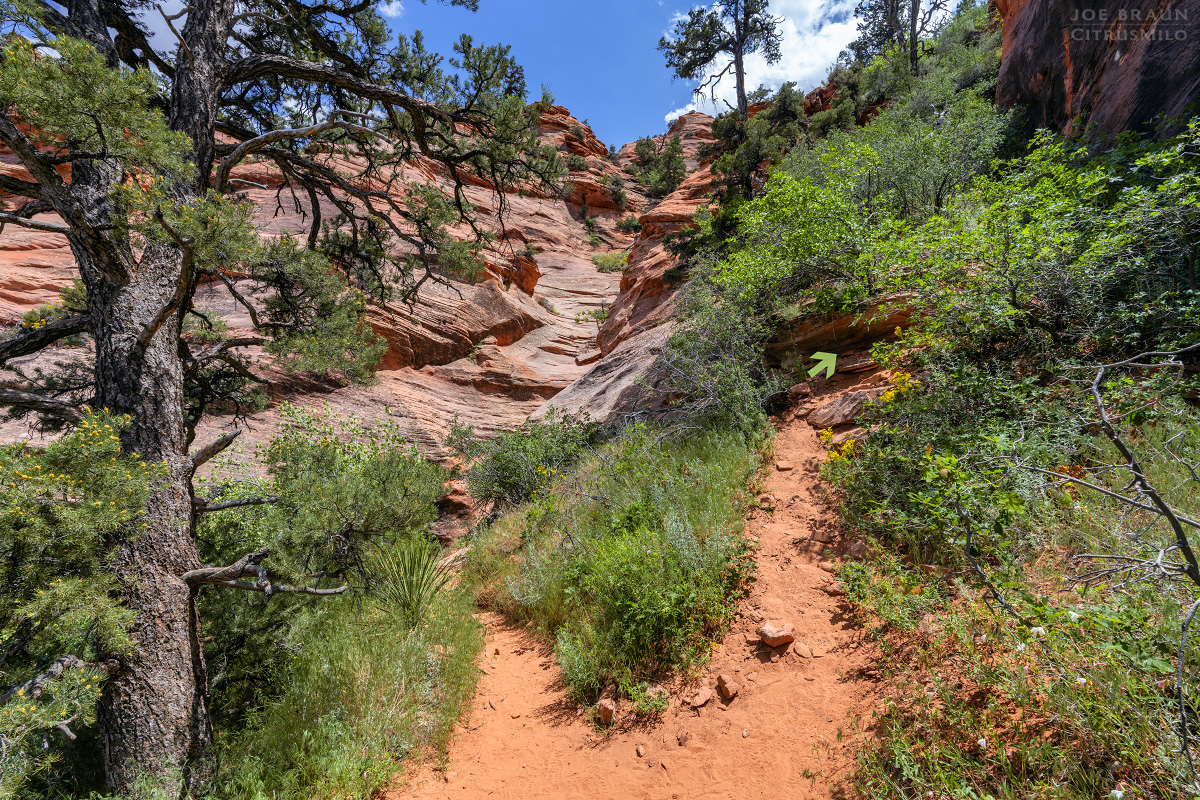
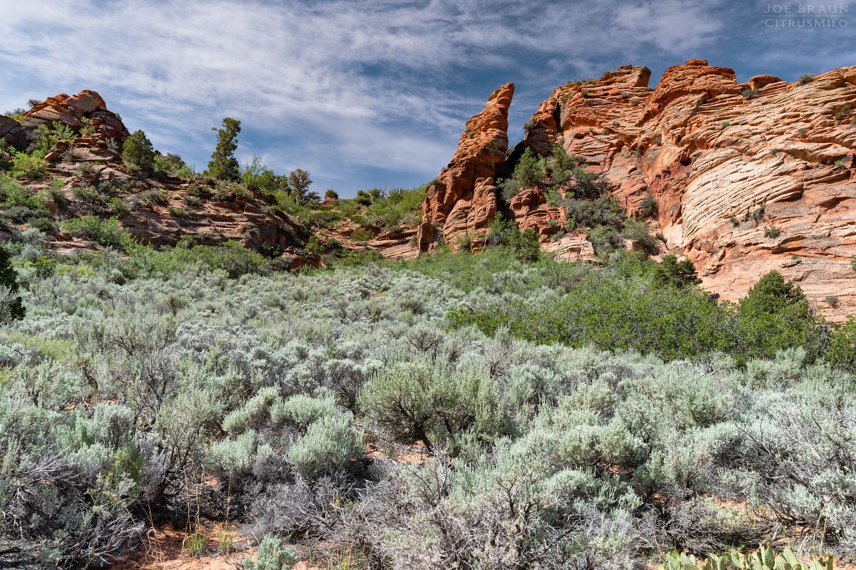
From the parking area and trailhead, hike the easy-to-follow approach trail south; you will see the complex Lambs Knoll formations directly in front of you. In a matter of minutes, you will reach the base of Lambs Knoll with several trails-of-use heading in different directions to the various little climbing and rappelling areas. Stick to the main trail-of-use as it heads south up into a prominent gully.
The trail makes its way up various shelves to gain elevation and soon enough, you will be standing at the head of the gully with a nice view behind you. (While there are a few spur trails that lead to various rappelling areas, it should be fairly easy to stick to the prominent trail that heads up.)
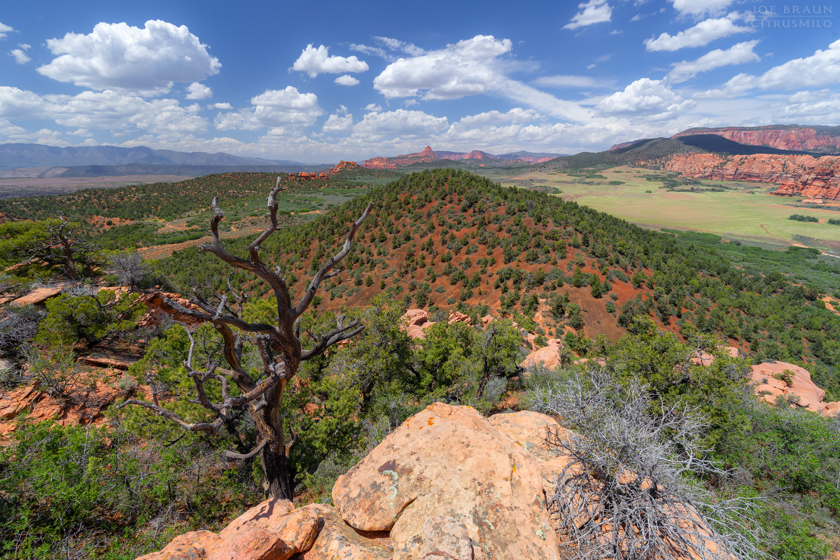
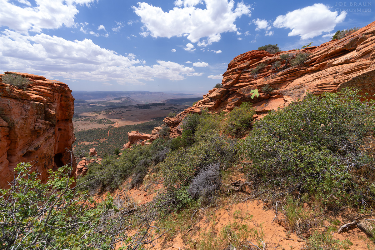
To reach the western high point (labeled "1" on the map), continue hiking uphill south until you reach the saddle that offers a nice teaser view to the south. Look up the slope to the northwest to find the spot in the wall where you can easily hike up. Once on top, there's no real trail, but you can wander around the plateau to get pleasant views in all directions.

Bagging the Lambs Knoll Summit:
The true summit of Lambs Knoll is labeled "2" on the map and offers a more dramatic view than high point 1. Backtrack north down from the saddle until you can hike around the base of the sandstone rib to get to the east; a somewhat faint trail should show the way. (You do not have to do any scrambling or climbing up or down at this point.) Once east of the rib, hike south up an open field of sage and gamble oak and up the sandstone bowl in the distance.
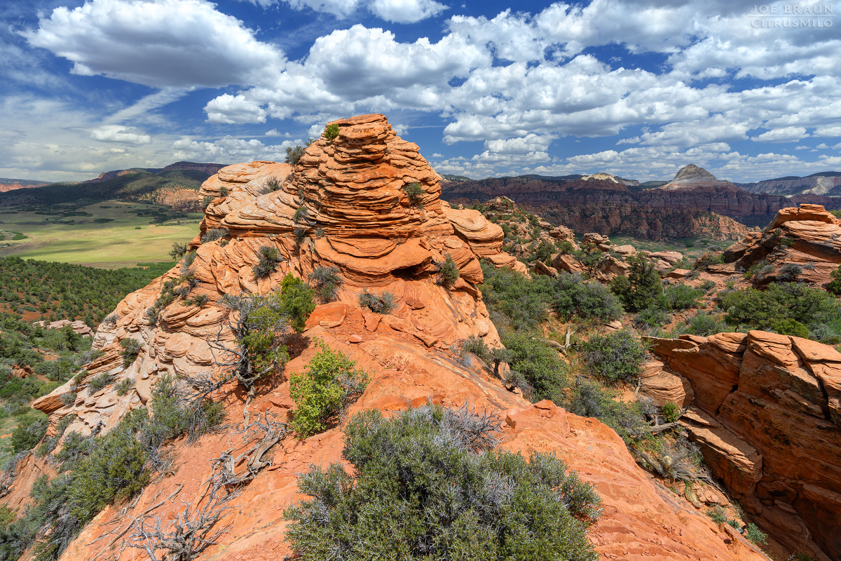
Once at the top of the bowl, you will see another nice teaser view to the south. The crux is a short Class 3 scrambling obstacle to get to the top of the little summit ridge. You can either climb directly up the side or head up the south side of the ridge. The scramble is short and not particularly difficult, but it is slightly exposed and may be intimidating to non-climbers.
Once on top of the little ridge, you will see the summit due north; take care as you hike up the shelves just to the left of the high point and then you can circle back stand on the summit. The views in all directions are spectacular for such a small little peak; many Zion peaks like Tabernacle Dome and the North and South Guardian Angels can be seen far off in the distance.
More Exploration of Lambs Knoll:
If you're in a hurry to simply bag the high point and be done with it, you can be in and out of Lambs Knoll in an hour. But since Lambs Knoll has a large terraced plateau with many irregular features, it is worthwhile to spend more time wandering around looking for alternative viewpoints. These are by no means the only places you can explore, but a few are listed below.
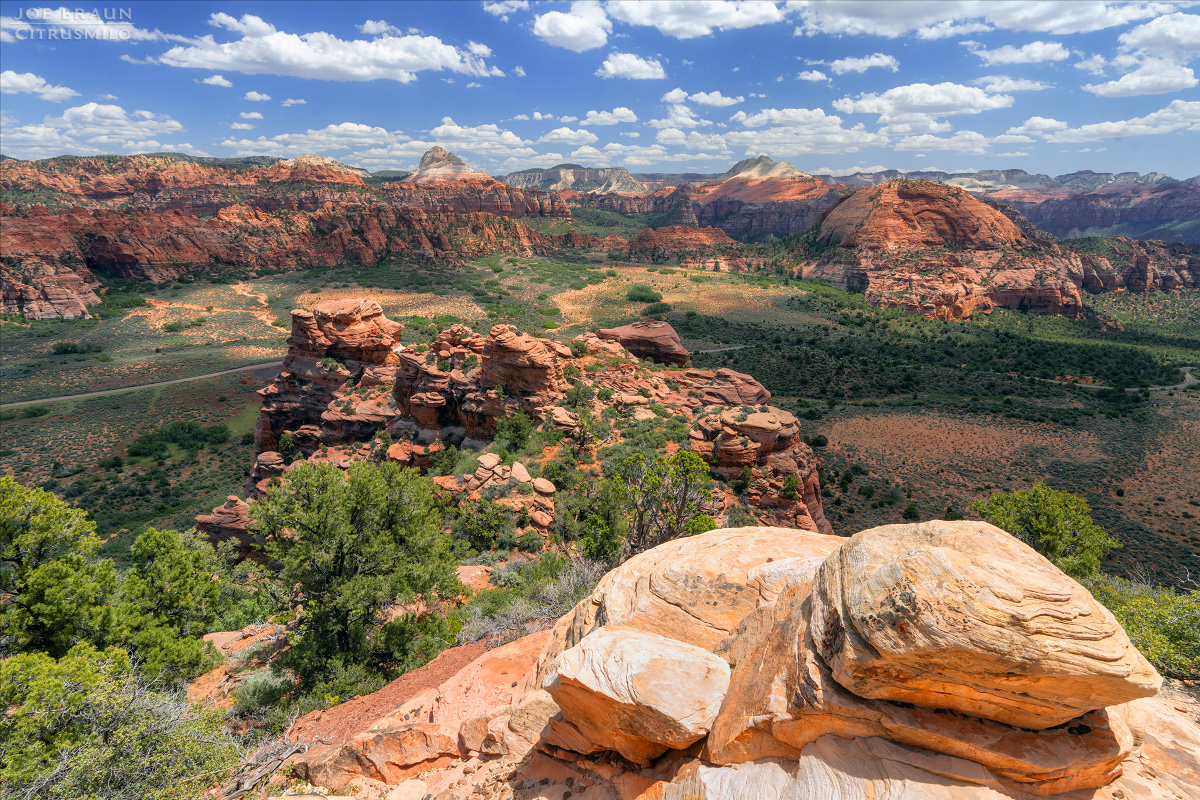
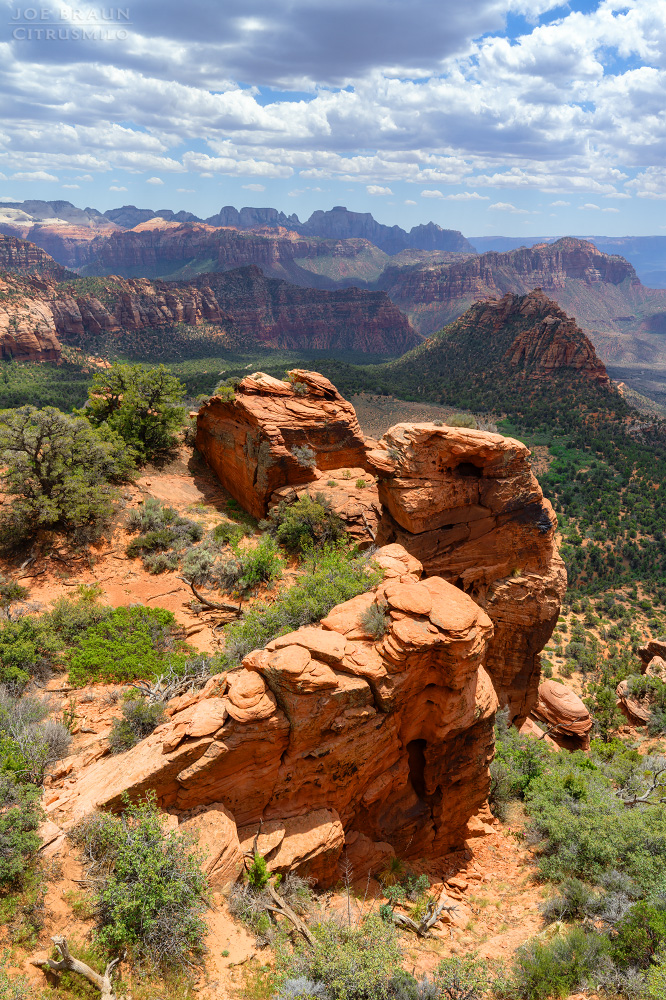
Right next to the summit is high point 3, which offers a similar nice view. Hiking along the southeast rim takes you to another (false) summit, labeled "4" on the map, which offers an even better view to the east. Hiking north to point "5" will take you to "table rock" viewpoint, which also gives access down into a few cave-like nooks and crannies. There are several trails-of-use that allow easy travel between the various points of interest. When you have had your fill of random exploration, hike back down the main access gully.
Joe's Spin:
I have to admit that I always ignored Lambs Knoll thinking that it was just a spot that guides take people for supervised climbing and rappelling, but Lambs Knoll is quite a cool geographical landmark to explore! It was a fun afternoon to wander around the various summit points looking for interesting views and there are plenty of spots that you can have all to yourself. Thumbs up!

