
A Beautiful Tributary of Kolob Creek:
Located just outside the boundary of Zion National Park (hence its name), Boundary Canyon is a tributary of the Kolob Creek pantheon that flows into the Zion Narrows. A descent of Boundary Canyon involves numerous big-wall rappels up to 100 feet, a hike down a beautiful stretch of Kolob Creek, and a difficult scramble up the infamous MIA exit route to get back up to the rim. This route makes for a long and strenuous day of canyoneering in some very pretty and remote territory.
⚠ WARNING: This is a technical canyon in a very remote environment and is not suitable for hikers who have no technical canyoneering experience. Navigation along the exit hike/scramble can also be tricky and intimidating.
Logistics:
- The initial approach hike along the dirt roads to the MIA route crosses private property owned by LDS. Please email requestRLA@ChurchofJesusChrist.org well before your intended hike to fill out a recreational license agreement. Obey any posted signs along the road to keep up the good will and to help preserve future access!
- Since Boundary Canyon is located outside of Zion National Park, no wilderness canyoneering permit is required if you exit up the MIA route. If you intend to continue down to the Zion Narrows, a wilderness permit is required for Kolob Creek as well as a top-down Zion Narrows permit. If you are planning to camp in the Narrows, try to get any campsite between 6 and 12 (the campsites between Kolob Creek down to Big Springs).
Getting to the West Rim Trailhead:
To get to the West Rim Trailhead, starting from the town of Virgin, drive roughly 19 miles up the Kolob Terrace Road and turn right at the well-signed dirt road turnoff for Lava Point. Once in the NPS boundary, turn left at the next road junction. The final stretch of dirt road down to the West Rim Trailhead is usually accessible to non-4WD vehicles, but it can be treacherous in wet or muddy conditions.

The Approach Hike:
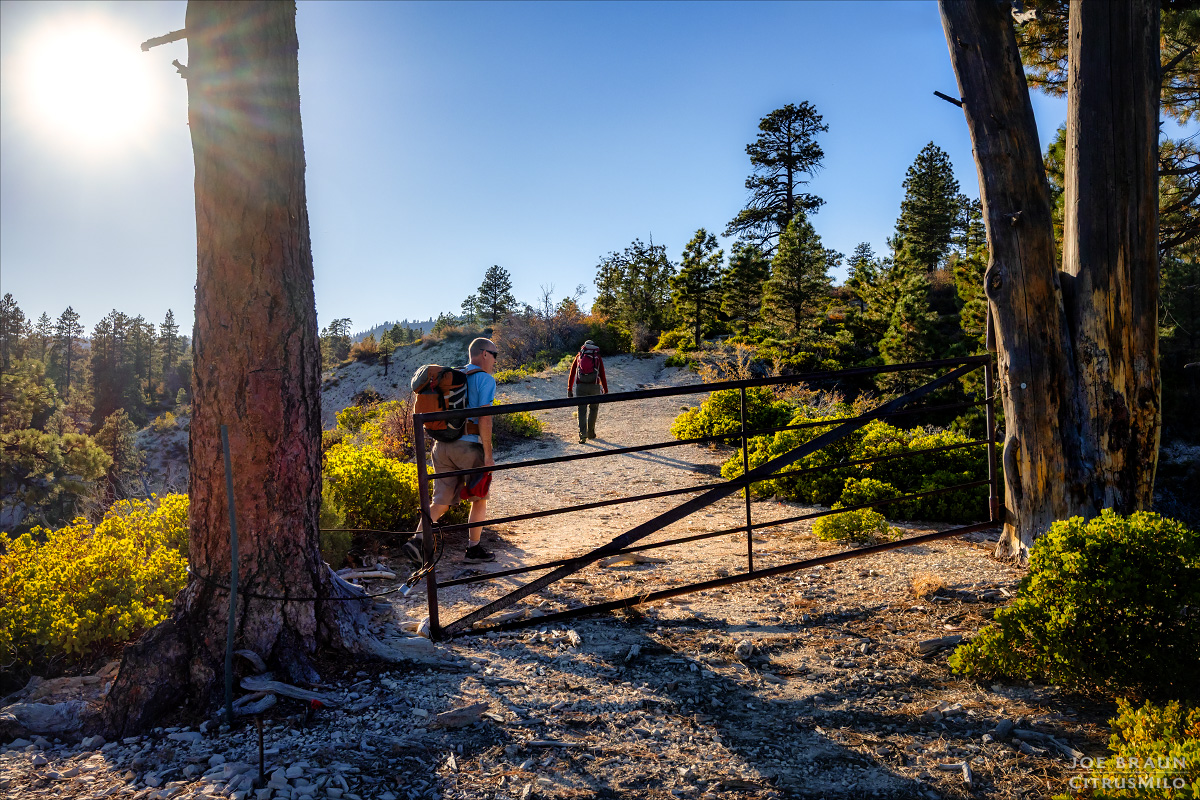
From the small parking area at the West Rim Trailhead, go past the gate and hike the dirt road east. At roughly 1.1 miles at the first road junction, stay left (east) and soon after at the second junction, go left (north/northeast). Soon after, you will reach the private property boundary with a big sign that says "No trespassing if you have not executed a recreational license agreement with the property owner." (Be sure to have your signed form with you on your phone just to be safe.)
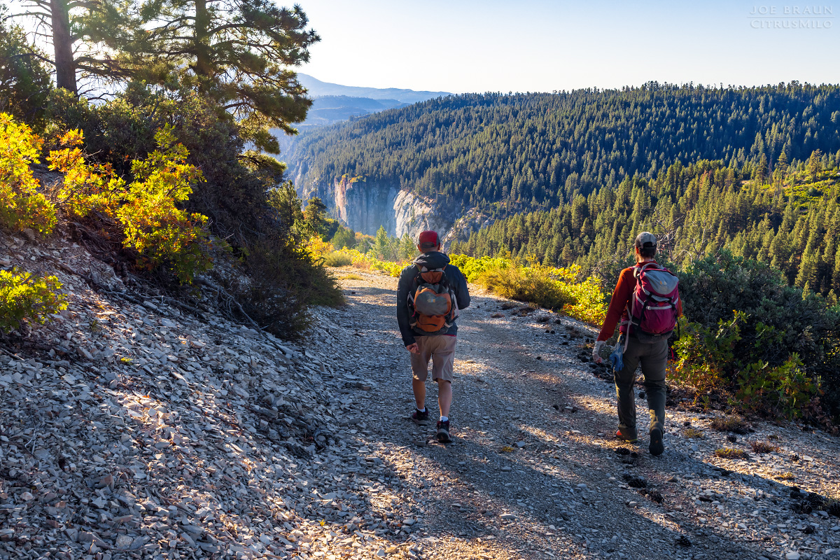
The old dirt road continues east, slowly descending the slopes above the canyon rim and then zigzags and loops counterclockwise around Kolob Creek. (Use the map and GPS to make sure you are following the correct road!) It is roughly 4.7 miles of easy dirt road hiking to get to the head of Boundary Canyon.
Descending Boundary Canyon:
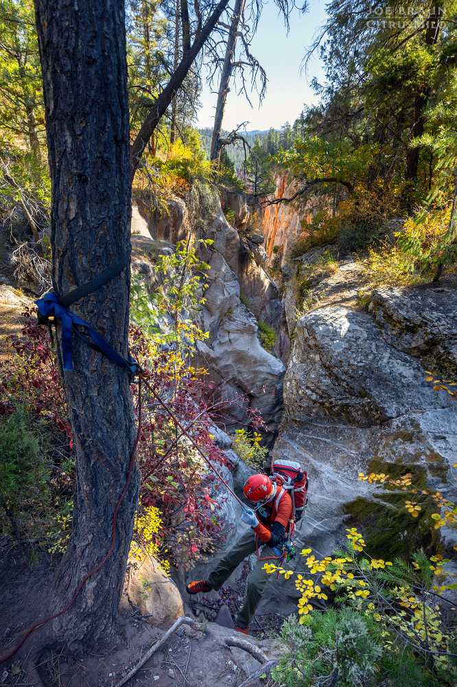
Boundary Canyon is typically dry and straightforward from the summer months onward, but if it is flowing from snowmelt or recent rains, be prepared for a more serious adventure. Once you are at the head of the canyon, it will be one rappel right after another for the short .3 miles of the technical section. This short canyon really packs a punch as far as fun rappels and amazing scenery.
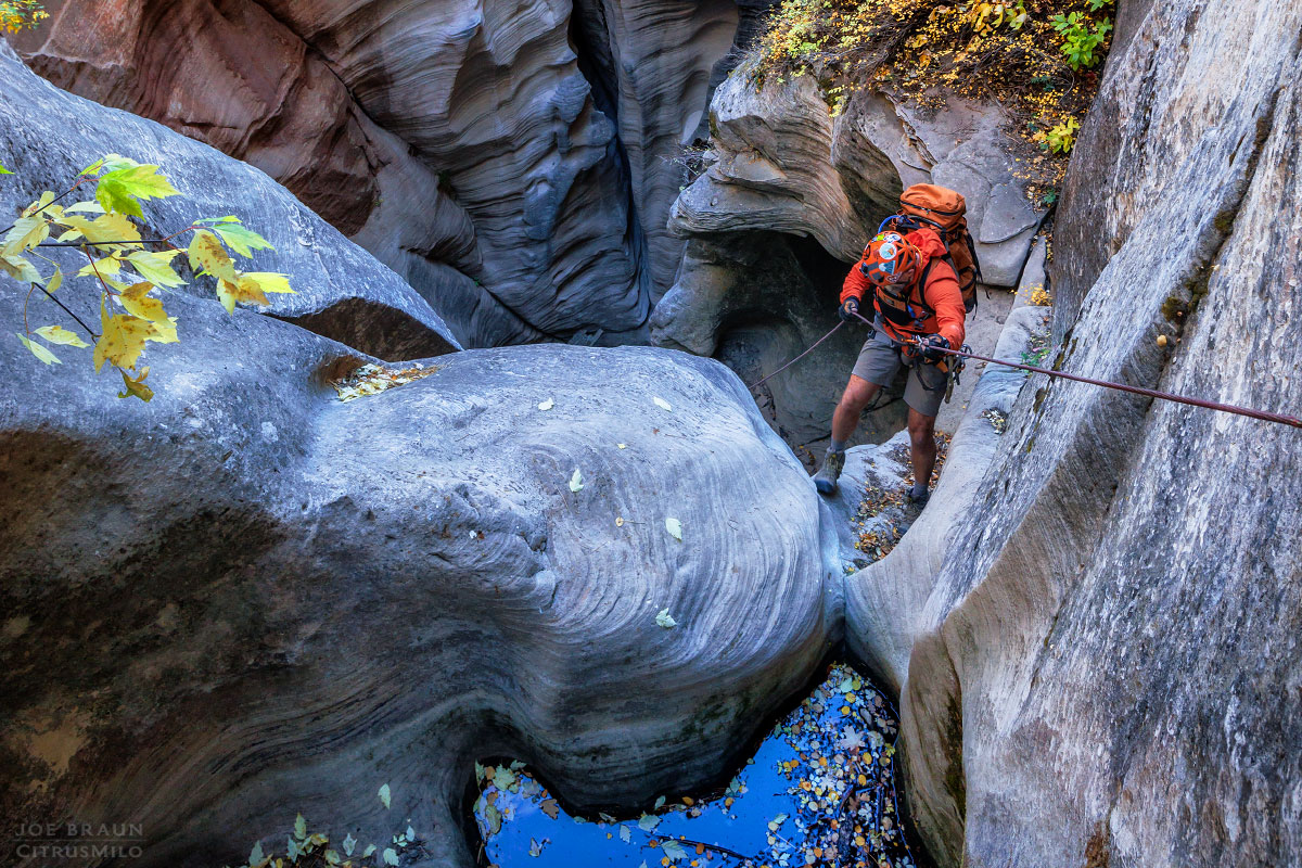
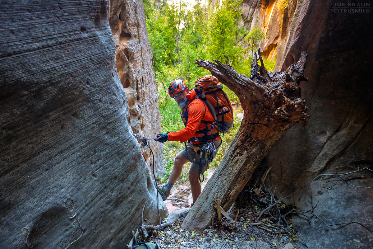
Rappel 1 is a 100-ft rappel from a tree near the rim on the left (north) side of the canyon; pass over two little potholes near the top and continue down to the landing area. Just around the corner are two bolts for rappel 2, another 100-ft drop that goes past a lovely sculpted pothole to a darker room below.
Rappel 3 is off a wedged log; downclimb to get on the 50-ft rappel that goes around the corner. And right around the corner is rappel 4, an easy 40-ft drop off of two bolts into a nice rounded alcove.
Next up is rappel 5 off of two bolts on the left. This is probably the coolest rappel in the canyon, descending a uniquely sculpted 90-ft wall with a little arch/bridge to walk through at the bottom.
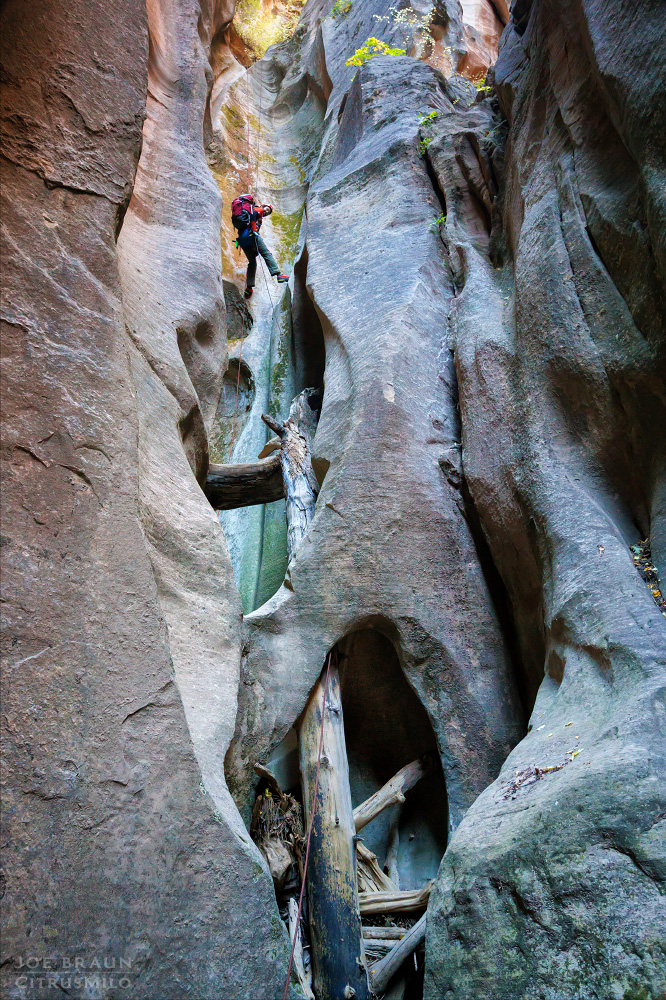
Rappel 6 is a 90-ft two-stage rappel off of two bolts in the left wall. Halfway down is a room that may have a deadman or some other natural anchor (for those who want to do this as two shorter rappels). Continue down into another dark alcove.
Rappel 7 is roughly 80-ft long off of webbing wrapped around a boulder on the ground; walk back around the corner to get to the long vertical rappel to the bottom of yet another beautiful narrow corridor. Right after is rappel 8, an easy 30-ft rappel off of a log.

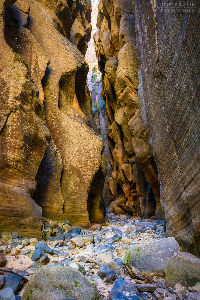
Next, we have a bit of hiking to do through a very tall and narrow section of canyon that has a minor boulder downclimbing obstacle and a short drop with a log that can be downclimbed. Soon enough, we reach the last rappel 9, a lovely 70-ft drop off of two bolts down the smooth wall out into the open. Lower Boundary Canyon is much wider than the technical section and is overgrown with trees. It's a fairly easy half a mile hike to the confluence with Kolob Creek.
Hiking Down Kolob Creek:
Kolob Creek feels like a bonus treat tacked onto the Boundary Canyon route. Even though this one-mile section of Kolob Creek from Boundary to the MIA exit is all non-technical, it is really beautiful. Kolob Creek usually has flowing water at the confluence, but it can dry up downcanyon, so if you need to filter water, do it here.
Continuing down Kolob Creek, the hiking is typically obstacle free, but there is one short narrow corridor that is typically filled with knee to chest-deep water that can't be avoided. Downcanyon the streambed often dries up and you enter a really stunning short section of tall dark narrows. And as soon as the narrow slot opens up again, it's time to look for the MIA exit route. It is marked by a large boulder (usually with a cairn on top of it) in front of a vegetated hill on the right (west) side of the canyon. Coordinates: 324566e 4138674n (UTM NAD27).

If your plan was to do Boundary Canyon as a day hike, now it's time to pay the piper! (Alternatively, you can continue down Lower Kolob Creek for an enjoyable two-day adventure, but you do need a permit for the Zion Narrows top-down route.)
The MIA Exit Route:
A lot has been written about how difficult the infamous MIA exit route is and after doing it myself, I have to agree. It's not just a strenuous uphill slog; there is some sketchy route-finding as well, which is always fun in vertical territory. Note: The "MIA" originally got its name from LDS’s "Mutual Improvement Association" using the route for youth group outings, but the more tongue-in-cheek "Missing-In-Action" acronym certainly plays into the route's infamous difficulty.
The MIA exit canyon has an impassable dryfall at the confluence with Kolob Creek, so look behind the MIA boulder for a trail-of-use that goes up the forested slope on the north side of the MIA canyon. This will lead you into the drainage of the canyon just above the dryfall. But we don't stay in the drainage for long; after scrambling up a pile of boulders, at the next interesting dryfall obstacle, start scrambling up a sandy chute that has a fairly prominent trail-of-use.

Continue up the strenuous line until you are out in the open and can see the far canyon walls in the distance. Scramble up several layers of sandstone until you are at the base of a cliffline. Looking to the west, you will see a north-south ridgeline that looks like it is blocking the route, but there is actually a fairly easy pass in the middle that is obscured by tall pine trees.
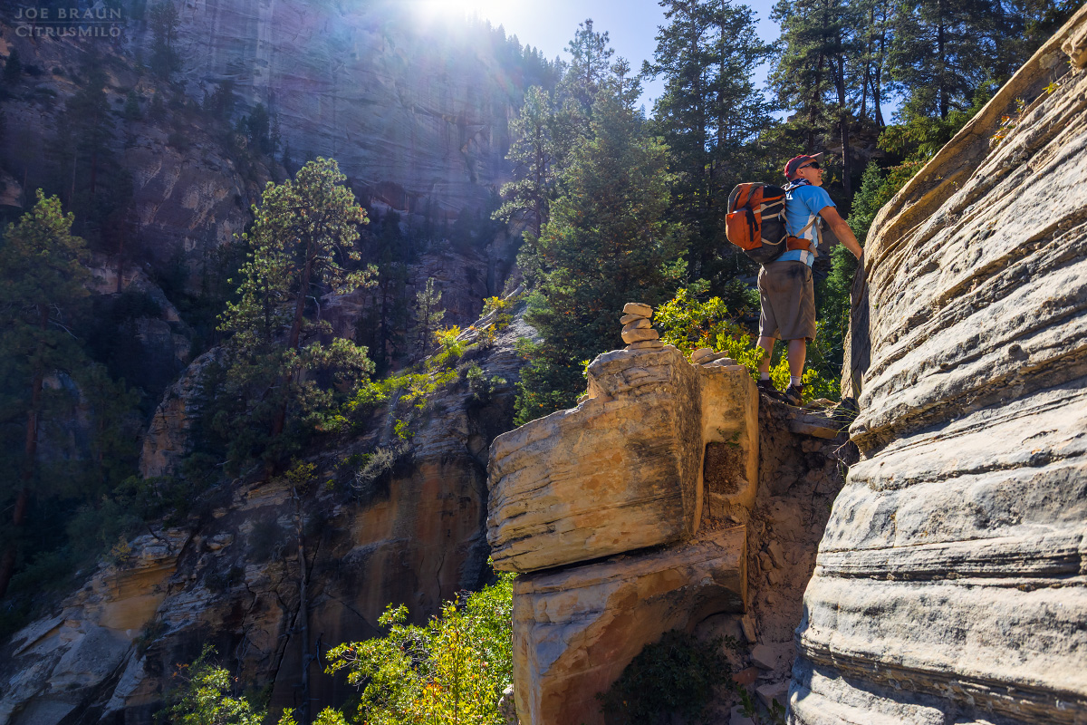
Follow the base of the cliffs west and try to stay as close to the wall as the irritating gamble oaks will allow you. Eventually you will head down a bit into a valley and then up the other side. Once you make it up to the pass in the north-south ridge, things will feel better and you'll see the top of the rim in the distance.

Continue hiking west down from the pass back into the drainage. There is a trail-of-use that can guide the way if you're lucky enough to stumble upon it. Back in the watercourse of the canyon for another brief stint, you will pass the mouth of the intriguing Pipe Spring Canyon slot canyon on the left (south). Hike up the watercourse for a few more minutes and look for a more prominent trail-of-use on the left side of the canyon that heads up a hill with a small gully just to the right of it.
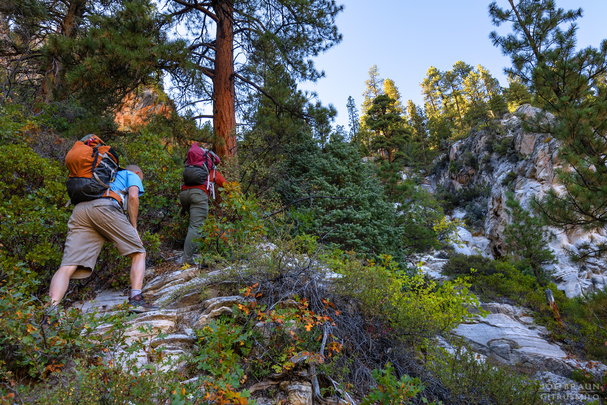
Now it's time for the final push. This trail-of-use continues west making its way up the steep and dirty slopes. While the trail is fairly easy to follow, there are a few spots where you might have to do a double take to find the next segment. Near the top of the MIA route is the steepest and most intimidating section, but soon enough you will make it into the forested pines at the top of the cliff. The MIA trail ends at the dirt road without any sort of signage or trailhead.
The Final Hike Out:
You may start celebrating that you survived the MIA exit route, but you still have two more miles of uphill road hiking to go! From the top of the MIA exit, start hiking the dirt road south (left). When the road will turns west, look for a more abandoned road that heads north. (If you miss it, there's a second road that you can take north.) The roads turn west and become much more prominent as you make your way up the hill. Continue west to complete the lollipop route back to the West Rim Trailhead!
Joe's Spin:
Boundary Canyon is a beautiful little canyon that packs a lot of incredible scenery into its .3-mile technical section and the section of Lower Kolob Creek that this route passes through is equally beautiful. The downside of course is that blasted MIA exit, but over time the pain and suffering will fade from your memory. Before doing this route, please be sure to get permission to cross private property on the approach and exit hikes to help preserve access in the future!

