

An Exposed Scramble up an Impressive Peak:
The North Guardian Angel is the impressive shark fin-like peak that can be seen in the distance between the Northgate Peaks from the end of the family-friendly Northgate Peaks Trail. A scramble/climb to the summit of North Guardian Angel makes for a great half-day adventure and consists of several pitches of exposed class 3/4 sections. While this route isn't a technical climb, it is spicier and more exposed than the Northgate Peaks and should be taken seriously.
⚠ WARNING: This scrambling route is exposed and has several class 3/4 climbing sections. This route is not recommended for casual hikers with no climbing experience.

Driving to the Trailhead:
The Wildcat Canyon Trailhead is an easy to spot parking area located 15.5 miles up the Kolob Terrace Road, roughly .8 miles beyond a sharp U-turn in the road that heads up a steep hill to the upper plateau. The trailhead has an official NPS marker and display case with information on hikes in the area, including the popular Subway "Top-Down" route which also starts at this trailhead.
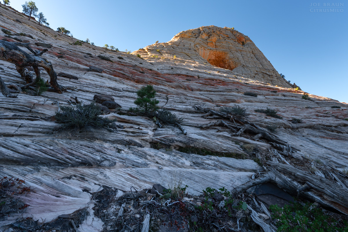
The Approach Hike:
Starting from the Wildcat Trailhead, hike along the well-defined Wildcat Canyon Trail (an old 4x4 road) as it meanders through mostly level terrain of a beautiful pinion forest scattered with open fields. After roughly a mile, the trail intersects with the Connector Trail to Hop Valley. Turn left (east) and continue along the Wildcat Canyon Trail towards Lava Point.
After only another .2 miles, turn right (south) onto the Northgate Peaks Trail proper. After only another .2 miles, you will see a signpost that marks the Subway Top-Down Route down into Russell Gulch, but stay on the main trail as it heads south through the forested meadows. After another mile, you will reach the end of the trail, a nice viewing area located on top of a pile of volcanic boulders--a perfect spot to relax and take in the view of North Guardian Angel off in the distance.

From the viewpoint, look to the east for a trail-of-use that descends the lava rocks to the valley below. Continue south between the Northgate Peaks and head cross-country straight for the base of the lower shoulder section of North Guardian Angel. Various trails-of-use may make hiking a little bit faster.
Climbing North Guardian Angel:
From the base of the imposing North Guardian Angel, scramble up the side of the shoulder, zigzagging your way up the various shelves. This section of the peak is only class 2 hiking/scrambling and should be pretty straightforward. Once at the top of the shoulder, you can get great views of the South Guardian Angel to the south and the numerous peaks in the distance to the north. If you're not looking for anything spicier, this makes a perfect destination in itself.

If your goal is the summit, it's time to look at the imposing formation above you and map out the route that you want to take. Zigzag your way up the initial class 3 slabs and ledges. While the route on the topo map makes it look like you hike straight up the middle of the spine, you really head more to the left (southeast) side as you make your way up. (At no point along this route should there be any difficult class 5 technical climbing section. If the route straight above looks too dicey, explore a bit more to the west before going up.)


Near the top, follow a short class 4 section up a line next to a wall. There may be one or two spicy obstacles, but feel around for good handholds in the wall and it will make all the difference.


Just under the summit block is a final pleasant little bench that you can hike up. Soon enough, you are standing on top of North Guardian Angel! Take in the amazing views and then take great care retracing your steps back down. Depending on your comfort levels, you might want to rig a handline or rappel at certain spots.


Joe's Spin:
This is a short but exciting scramble to the top of one of the most notable peaks in the Zion Kolob Terrace; it was a thrill to stand on the summit! The big question everybody has is: Is this climb too difficult for me? I'd say if you are an experienced climber, this route won't be very difficult or intimidating. (I'm a mild-mannered 5.9 climber and I thought the route was perfectly reasonable even with the exposure. I did not feel the need for any ropes.) But if you have little or no climbing experience and are afraid of heights, this route is probably not a good idea.

