
A Bite-Sized Canyoneering Adventure:
Walker Gulch is a smaller tributary on the north side of Orderville Canyon, located roughly one mile down canyon from the big drop that marks the start of Orderville Canyon proper. A loop "hike" through Walker Gulch from the lower Orderville Canyon trailhead can take roughly 4-6 hours and involves one long 160-ft rappel in addition to a few short rappels and/or downclimbs. This canyon might not be as exciting or as full of an adventure as Birch Hollow or Englestead Hollow, but there are several nice slot sections that make this a pleasant bite-sized adventure.
⚠ WARNING: This route is not suitable for hikers who have no technical canyoneering experience.
Logistics:
Walker Gulch is located entirely on BLM land and as such, you do not need a Zion National Park canyoneering permit to do this canyon if you are doing the simple loop route. If you plan on continuing down Orderville Canyon into Zion National Park to the Zion Narrows and the Temple of Sinawava, you DO need a Zion canyoneering permit for Orderville Canyon. Complete info on the NPS canyoneering permits page.

Getting to the Trailhead:
To get to the Orderville Canyon trailhead, from the east border of Zion National Park, drive 1.7 miles east on Route 9 and turn left (north) on the North Fork Road. Roughly 11.5 miles up the winding road, you will see a short dirt road to the west, designated by the BLM Orderville WSA (Wilderness Study Area) markers. Low-clearance 2WD vehicles can park here at the upper Orderville Canyon Trailhead.
If you have a capable high-clearance 4WD vehicle, you can continue through the gate (please be sure to close it behind you) and drive another two miles down the rough and pitted dirt road. A few sections in the first half mile can be really steep and sketchy, so proceed with caution. (Getting your vehicle stuck here would be a real bummer.) At the end of the 4WD road is a small parking area and another BLM display and register. This lower trailhead is the most convenient place to start a lap through Walker Gulch.
The Approach Hike:
The approach hike might take roughly 1.5 hours at a moderate pace with no navigation issues. From the lower Orderville Canyon trailhead, walk down the drainage only for a minute or two and then head due west cross-country through the scrub brush vegetation until you reach the base of the hills only a third of a mile away from the parking area. Find and hike any reasonable line up the slope and once at the top of the initial hill, look for an open area with a few cut tree stumps (UTM 334511mE 4132995mN). This is an old open camp area along the abandoned logging road.
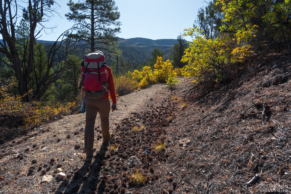
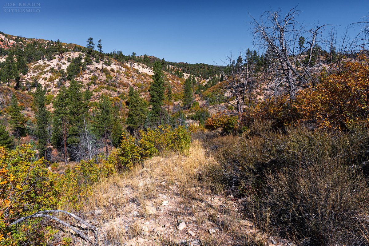
From here, you should be able to follow the old logging road west as it loops its way around various gullies and then starts heading north. Many sections of the old road are obvious, but there are few sections where you might have to sniff the route a bit. Once heading north, you can get a nice view of Walker Gulch in the distance as the road squiggles around to the head of the canyon. When the road crosses over the drainage, head down Walker Gulch and the fun begins!
The Route through Walker Gulch:
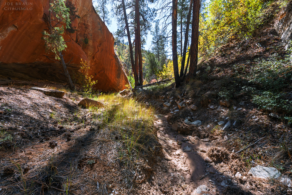
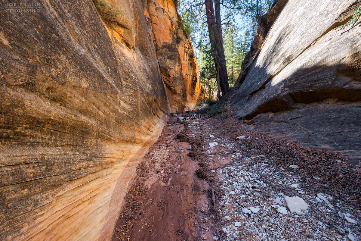
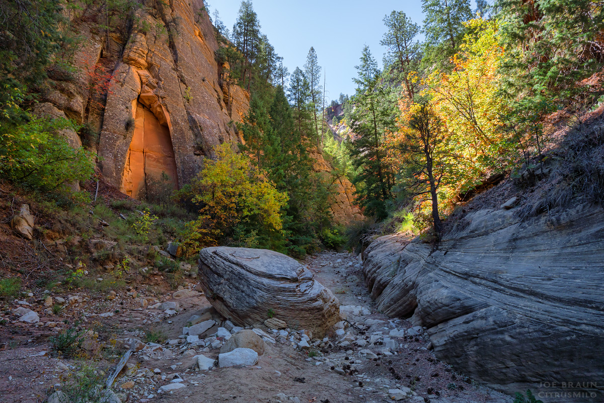
Walker Gulch starts out looking mellow, but within moments you will reach a tall initial cliffband (somewhat similar to the first bowl in Birch Hollow). The edge of the cliff is a thin undercut layer of sandstone so do not risk walking to the edge; pieces of that top band are ready to collapse. Staying far from the rim, hike around the left (east) side and find a reasonable line to scramble down the scree into the vegetation below. (This part of the bowl already collapsed.) Once down in the wash, continue hiking through the pleasant scenery. Sections of open wash alternate with a few short shallow slot sections filled with random logs.
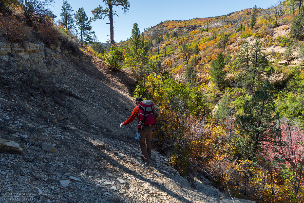
Roughly .6 miles into the canyon, we reach the big rappel of the day: a 160-ft rap down the watercourse of a fluted chute into the belly of the canyon. The preferred anchor is a big boulder about 20 feet back from the drop, so bring plenty of webbing just in case you need to re-rig the loop around the boulder. Also allow for extra rope length if the quicklink is back from the edge. (We used a 200-ft rope and pull cord which was overkill, but it's nice to be safe.) Note that some people have previously rigged off of a tree on the left side of the canyon, but the approach is sandy and outward-facing so it's not recommended.

Just down canyon from the big rappel is a series of steep log-filled bowls that you might want to downclimb or do short 10-ft rappels through. The logs provide ample anchor material. Soon after is an easy 15-ft rappel off of a bolt in the right/west wall.
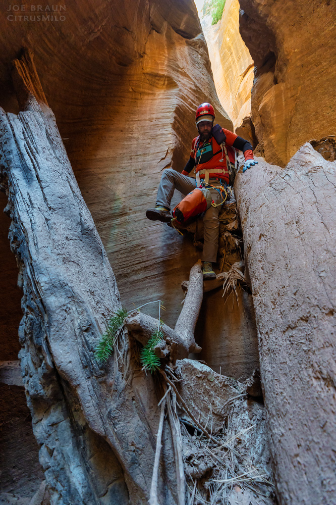
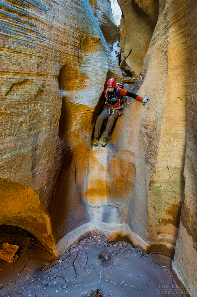
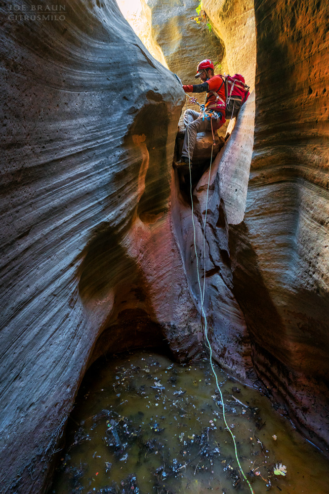
Now we're in the short-but-sweet golden section of the canyon with beautifully-sculpted walls towering above. As you make your way through the canyon, you might do two more short 15-ft rappels off of bolts down chutes. If there have been recent rains, the bottom of these chutes will likely have small muddy pools.
Sadly though, just as the canyon starts feeling like a lot of fun, the slot section mellows out and after a bit more hiking, we reach the junction with Orderville Canyon.
The Exit Hike:
If you were lucky enough to park at the lower Orderville Canyon trailhead, simply hike back up Orderville Canyon to your vehicle. It's roughly a 1.7 mile hike from the confluence of Walker. At the big dryfall in Orderville Canyon, you can find numerous trails-of-use to follow up the the right/east side to the upper gulch.
If you had to park at the upper Orderville Canyon trailhead, it's another 2.1 miles and 600 feet of elevation gain to get back to your car. It looks easy enough on the map, but that last uphill always feels brutal at the end of the day.
Alternatively if you can't park at the lower Orderville trailhead, you could spot a car near the Wild Wind Hollow exit (similar to what some do for Birch Hollow) although the effort you would save in this case is questionable. And of course, Walker Gulch can be done as a side quest to a full top-down Orderville Canyon route. (Permit required for Orderville Canyon to the Temple of Sinawava.)
Joe's Spin:
I really like this short little canyon, but admittedly just as you start enjoying it, it's over too soon. I understand why this canyon remains off of most people's must-do lists, especially with several more exciting canyons so close by. In many ways, this canyon is similar to Birch Hollow (same geographical layers), but it has a bit less of that slot canyon and rappelling goodness.

