All maps on "Joe's Guide to Zion National Park" use UTM and NAD27 Datum for coordinate display. While there are several alternate standards and systems, I prefer UTM and NAD27 for two reasons:
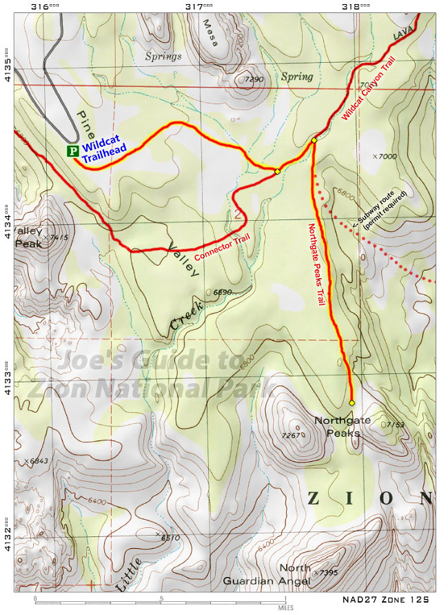
If you use any of the maps on this website to help with navigation, please be sure that your GPS unit is using the same settings! If you accidentally have your GPS set to WGS84 Datum, you will appear to be roughly 200 meters off target. The National Geographic Trails Illustrated Map for Zion National Park is also highly recommended to give you a complete overview of the layout of the park and the locations of various hikes.
Note: The history and technical details of coordinate systems are quite complex (and will not be explained here!), but many books and websites give laboriously thorough explanations.
Please note: This web site and all images on this site are the property of CitrusMilo Adventures ©2026. Unauthorized public or commercial use of any of the images or text on this website without explicit permission is strictly forbidden.


